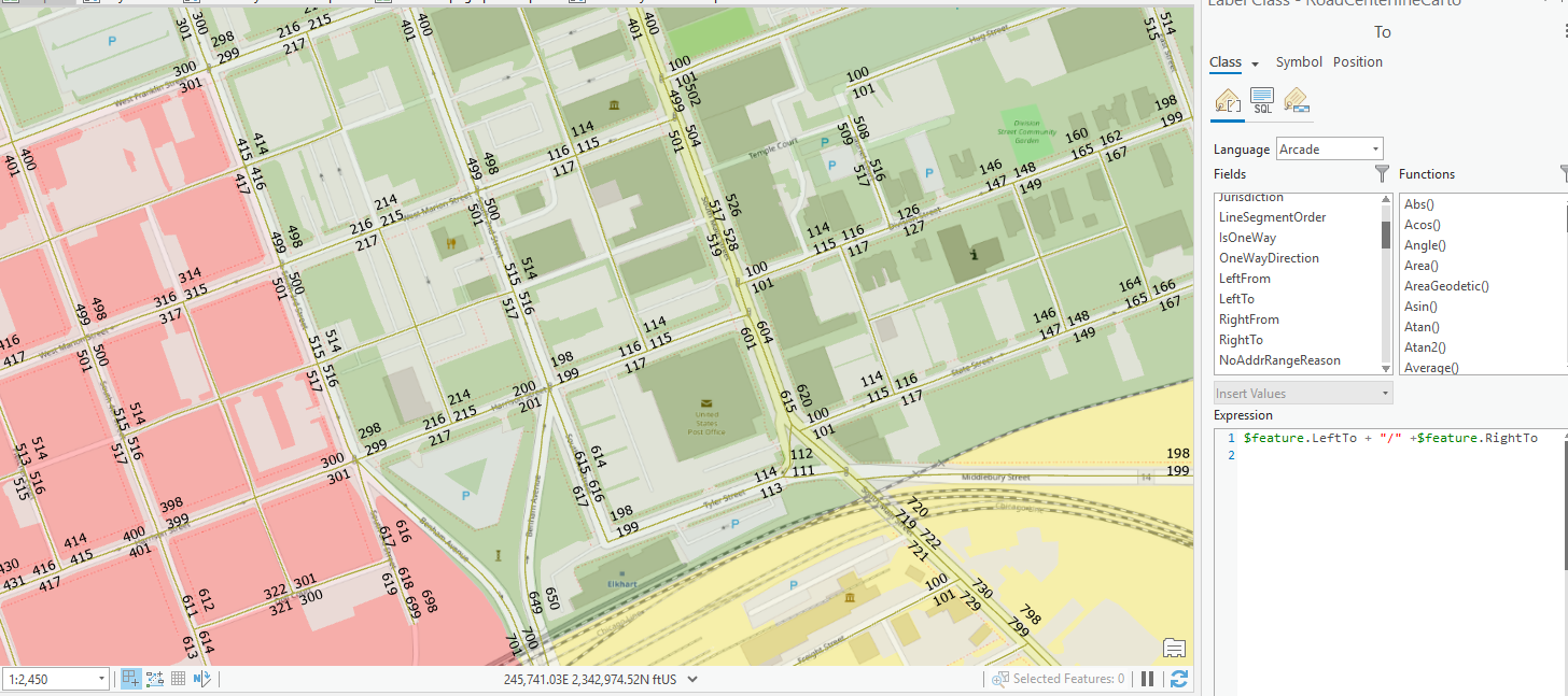
Do not have a true address range grid and addressing I somewhat sporadic. Am trying to fulfill a request for a map that displays address ranges so the end user can decipher the transition of ranges pertaining to district boundaries.
Have gone through the SOP Label street address ranges—ArcGIS Pro | Documentation , but the centerline I am using is not processed to depict the width of the street like you would see with the Open Street Map streets.
The goal would be to have four label classes:
- Left To & Right To Even
- Left To & Right To Odd
- Left From & Right From Even
- Left From & Right From Odd
I do have an edge of pavement layer that I could work with using the centerline data in a spatial join.
Feedback would be appreciated.
Thanks