Hi All,
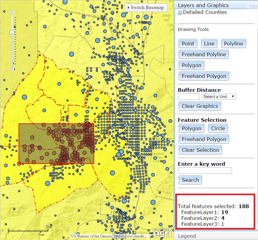
I have a web map and the issue I'm having is, when I select features using either Polygon, Circle or Freehand Polygon buttons for the first time as shown in Figure A, it displays the correct figures for (Total features selected, FeatureLayer1, FeatureLayer2 and FeatureLayer3). However, when I clear selection (using the Clear Selection button) and make another selection (Figure B) the figures displayed are incorrect. The Total features selected from the previous selection is added to the current Total features selected figures. The figures of FeatureLayer1, FeatureLayer2 and FeatureLayer3 are also not correct. This is the link to the web map, similar to the one I'm using. Can anyone please show me how to correct this issue?
Thanks
Figure A
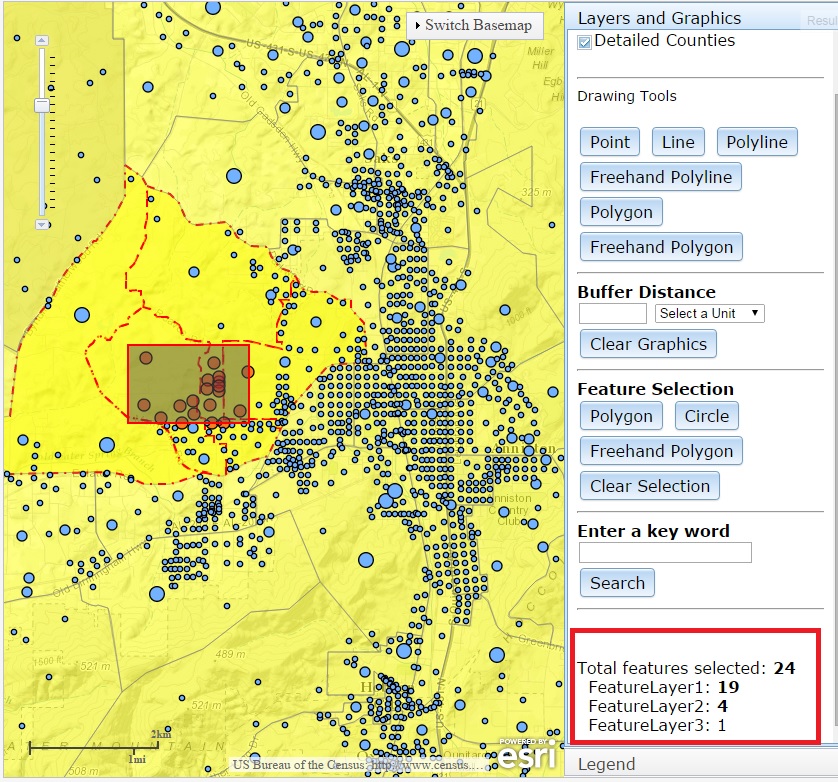
Figure B