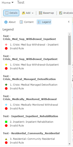
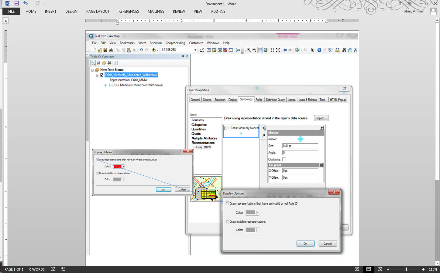
I have created a python script that uploads 20 layers that each have their own Representation to ArcGIS Online. Unfortunately, in the legend for each layer I have an "Invalid Rule" symbol. To my knowledge all of my features have drawn properly and there are no invalid symbols in the map. How do i get rid of this "Invalid Rule" in the legend using python (this is a weekly process and I do not want to manually fix 20 layers every week)? It does not appear in the legend in ArcMap. I know there is a "Display Option" in the Symbology tab in ArcMap that allows you to deselect the "Draw representation that have an invalid or null Rule ID" box. When I deselect it and exit out of the Layer Properties it says that the changes will be saved directly to the geodatabase but when I remove the file from the Table of Contents and add it back into the map the "Draw representation that have an invalid or null Rule ID" box is checked again.