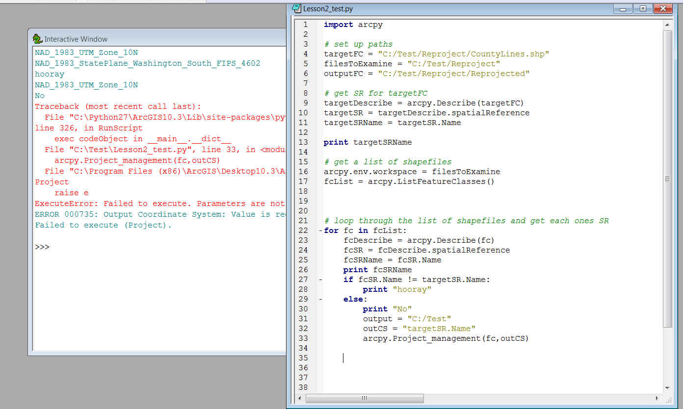
I am very, very new to Python and I am trying to write a script that will allow me to Project shapefiles into a coordinate system that is assigned to one particular shapefile in a folder. So I have 4 files and one has that which I want to re-Project the others into. What I am struggling with is the output CS parameter required by the Project_management tool when called in the script. I get an error message saying that the output Coordinate System value and the outputFC parameter is not valid. I'm wondering where I'm going wrong.
Any help at all would be so greatly appreciated.
Sincerely,
Natasha