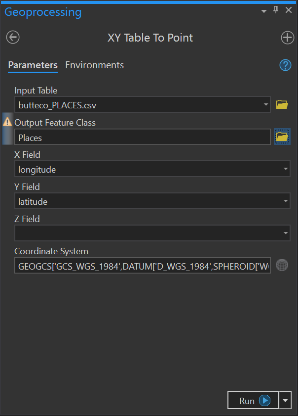
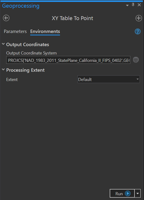
I have three (3) CSV formatted files containing geographic coordinates (I attached one). When I use XY Table to Point to create point features from any of them, I cannot get valid results if I set both the input SRS and the output SRS (via the Environment settings). In my case, the input SRS is WGS84; the desired output SRS is NAD83-2011 State Plane CA-II (0402).
 |  |
| Parameters | Environments |
|---|
The XY Table to Point tool does create points, but it misinterprets the desired output SRS as the defined input SRS and, so, plots all the points near the false origin of the CA-II coordinate system (i.e., out in the Pacific Ocean).
I now have to use a two-step process to accomplish what used to be a one-step process: 1) use XY Table to Point to create point features tied to the input SRS; then 2) use the Project tool to handle the coordinate conversion.
I'm running ArcGIS Pro 2.5.0 on Windows 10 Pro.


