Hello all,
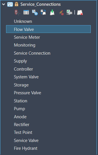
I'm currently exploring the use of this plugin for my organization. We are a water utility and are using a Utility Network dataset for our features that we wish to see in AutoCAD. When adding feature classes from our Utility Network into either subtype group layers or as standard layers with definition queries I'm still seeing all of the subtypes appear inside of the ArcGIS for AutoCAD contents pane. This makes using the layer list and ArcGIS contents quite cumbersome as many of these are irrelevant.
I've tried to use the Esri_FeatureLayer Manage Subtypes but I don't seem to be able to remove excess subtypes. Is there a step I'm missing in the configuration of the service or drawing to remove these?
I've attached a picture of one of the layers. This layer was not configured as a subtype group layer in the service. Yet, all of the subtypes are still visible. When trying to use the Manage Subtypes command I receive the following message: This layer does not support custom sublayers because it has service defined subtypes.
If anyone else is from a utility and using this plugin I would also be interested in getting in contact learning your workflows/use cases.
Thanks!

