A map used to feel like an answer.
You opened it, found a road, located a river, checked a boundary, or searched for a city. The map told you where something was. For many people, that is still what a map means: a useful picture of the world.
But GIS changes that picture.
In GIS, a map is not only a place to look. It is a place to ask questions.
Why does one neighborhood flood after heavy rain while another stays dry? Why does one family live ten minutes from a hospital while another lives forty minutes away? Why does a river slowly move toward farmland, roads, or homes? Again, why does a city keep expanding into areas that may be unsafe during storms?
These questions are not just scientific; they are practical. They shape where people live, how they travel, how cities plan, how emergency teams respond, and how communities get ready for the future.
The next generation of GIS professionals must go beyond map creation. Their role is to turn spatial information into compelling evidence for action.
These are not just abstract results. They are real decisions tied to specific places.
The Map Is Growing Up
The old idea of a map was simple: show the world.
The new idea of GIS is different: explain what is happening in the world.
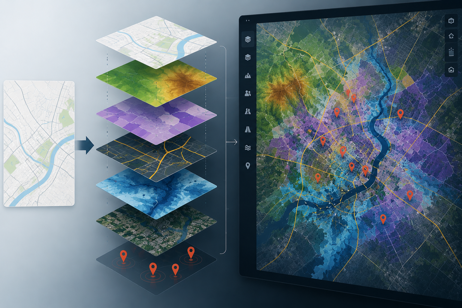
A printed map can show a coastal town, whereas a GIS workflow can show how that coastal town may behave during a storm. It can combine roads, elevation, bridges, shelters, hospitals, population, past erosion, and flood zones. Suddenly, the map is showing more than just where the town is. It is helping answer urgent questions.
- Which road may flood first?
- Which neighborhood has fewer ways to evacuate?
- Which hospital route should stay open?
- Where should emergency supplies be placed before the storm arrives?
To someone outside GIS, this might just seem like a map with extra layers. But for a GIS professional, it is more than that. It is a way to connect facts that are usually kept apart.
A road map by itself cannot explain risk.
A population table by itself cannot show exposure.
An elevation model alone cannot show who lives in low-lying areas.
A satellite image alone cannot determine what action should be taken.
GIS brings all these pieces together.
That is where the profession is growing.
GIS Is Becoming a Translator
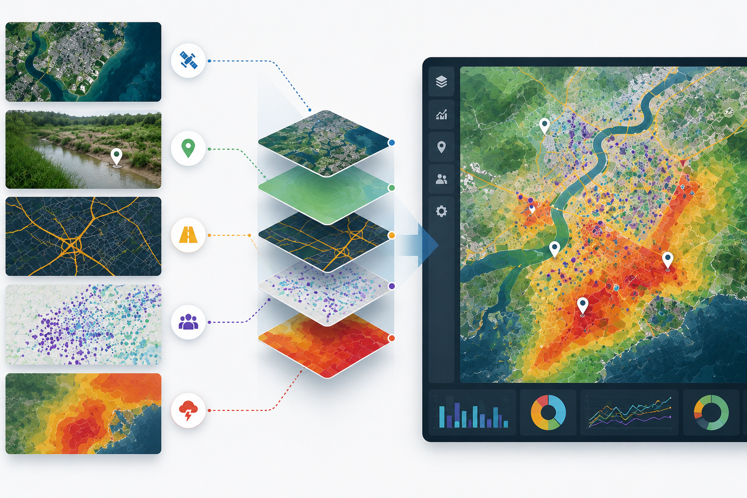
Most people do not make decisions using raw data. They decide based on information they can understand.
A city official may not have time to study satellite imagery. A nonprofit director may not know how to calculate travel-time access to clinics. A school administrator may not work with road-network data. A local community may not read a technical flood model.
This is where GIS professionals matter.
They translate complex data into clear evidence.
For example, instead of saying, “This area has a high-risk raster value,” a GIS professional can show, “These blocks are most likely to flood first, and these are the roads people would depend on to leave.”
Instead of saying, “This census tract has poor service coverage,” they can show, “Families in this part of the county may need twice as long to reach urgent care.”
Instead of saying, “The shoreline moved 20 meters,” they can show, “This section of beach is narrowing, and the road behind it may become more exposed during future storms.”
That translation is not just communication. It is expertise.
A GIS professional becomes an editor of spatial evidence: deciding what data to trust, what patterns to question, and what uncertainty to explain.
Good GIS work helps people go from confusion to action.
The Future Will Ask More From GIS Professionals
The future will bring more data, not less.
Satellites will collect more images. Drones will collect more detailed surfaces. Sensors will report more ecological variations. Field apps will collect more real-time observations. Dashboards will update faster. AI tools will classify land, detect buildings, and process large datasets more quickly.
But having more data does not always lead to better decisions.
In fact, more data can cause more confusion if no one knows how to organize, test, or explain it.
That is why GIS professionals will be even more important. Their job is not just to use new tools. They must decide which data matter, which results are reliable, and how to explain uncertainty clearly.
A future GIS professional may need to look at an AI-generated flood map and ask:
- Is this actually floodwater, or is it shadow?
- Is the satellite image recent enough?
- Are small roads missing from the network?
- Does this model include people without cars?
- Would a person living there agree with what the map is showing?
These questions require good judgment. Software can process data, but people still need to understand the area.
AI might make GIS faster, but spatial reasoning is what makes it trustworthy.
GIS Will Touch More Parts of Everyday Life
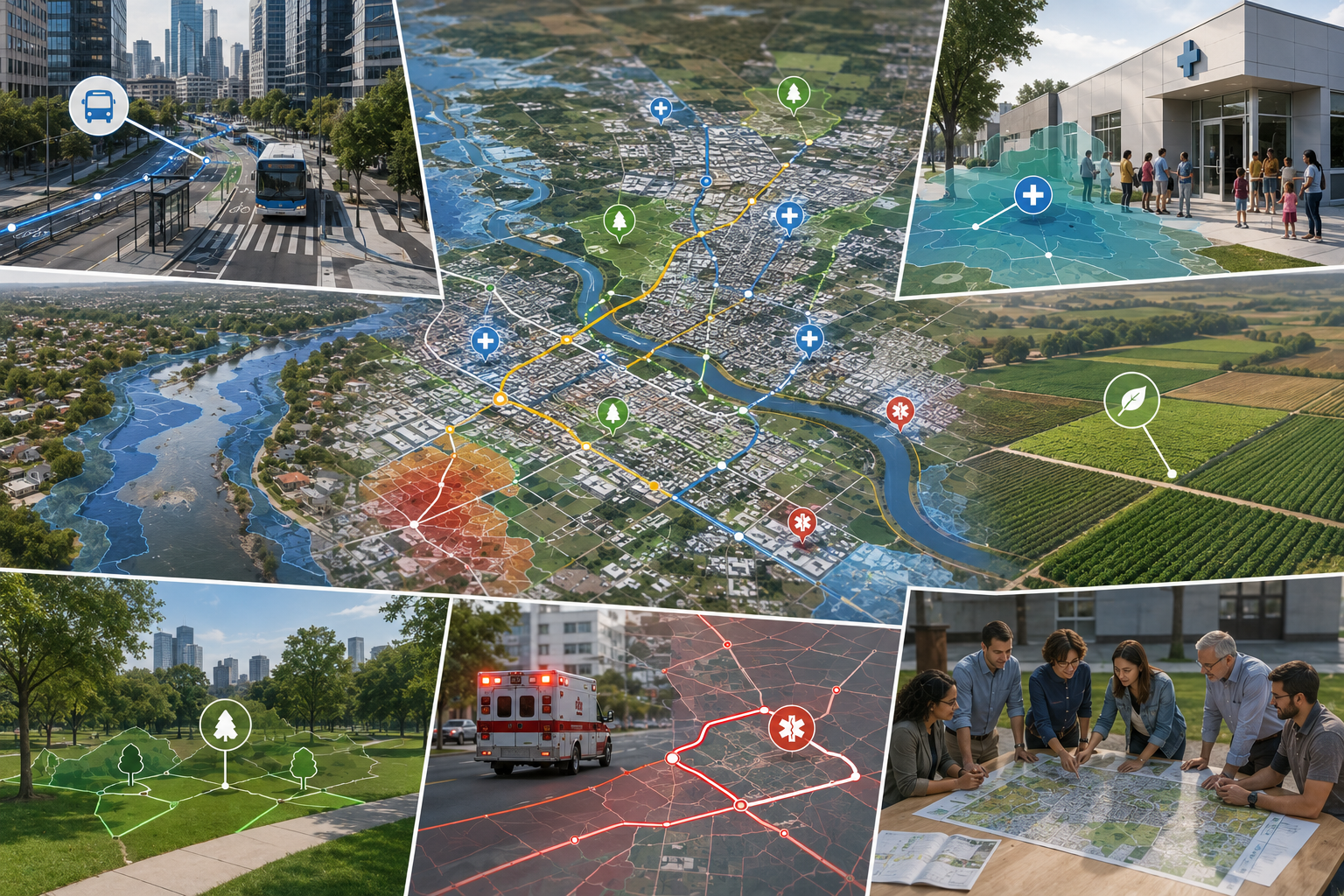
For non-science audiences, the easiest way to understand GIS is to think in terms of daily life.
When deliveries arrive faster, or cities repair sidewalks efficiently, GIS is involved.
When counties place clinics or emergency teams choose response locations, GIS is involved.
When a county places a new clinic, GIS may be involved.
When emergency teams decide where to send help first, GIS may be involved.
Farmers choose crops, planners study conditions, and they often rely on GIS.
When planners study heat, traffic, pollution, or green space, GIS may be involved.
GIS often works quietly behind the scenes. People may not notice the software, but they experience the results.
A safer walking route.
A better bus stop location.
A faster emergency response.
A smarter flood shelter plan.
A clearer picture of where development should or should not happen.
This is why GIS is not just a technical field. It also serves the public, even when the work is done on a computer.
The Profession Must Become More Careful, Not Just More Advanced
As GIS grows more powerful, it also carries more responsibility.
A beautiful map can be wrong. A dashboard can look official but still rely on limited data. An AI model can produce a confident result that does not correspond to the ground truth. A risk map can influence funding, planning, insurance, emergency response, or community confidence.
This means GIS professionals must be careful about what their maps show.
They should ask:
Where did the data come from?
When was it collected?
What is missing?
What scale is appropriate?
Could this map be misunderstood?
Who might be affected if the result is wrong?
Being careful is not a weakness. It is what defines a GIS professional.
A GIS product is stronger when its limits are clear. This does not weaken the work; it makes it more useful.
The future of GIS is defined by how effectively maps help people make fair, accurate, and actionable decisions.
What Emerging GIS Professionals Should Build
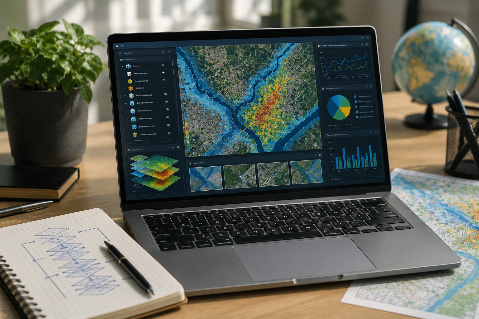
For students and early-career professionals, the future can feel overwhelming. There are many tools: ArcGIS Pro, ArcGIS Online, ArcGIS Field Maps, ArcGIS Survey123, Python, SQL, JavaScript, drones, remote sensing, dashboards, AI, cloud platforms, and web maps.
But you do not need to learn everything at once.
The real goal is to develop a way of thinking.
First, learn the foundations: projections, coordinate systems, spatial joins, geodatabases, raster and vector data, topology, scale, and map design. These are the basic languages of GIS. Without them, analysis can quietly break.
Second, learn how to work with imagery. Satellite and drone data can show change across time: flooding, erosion, construction, vegetation loss, crop stress, urban growth, and storm damage.
Third, learn automation. A repeatable workflow is stronger than a one-time map. Python, SQL, ModelBuilder, and web GIS tools can help make work faster and more reliable.
Fourth, learn to explain your work. A strong GIS professional should be able to tell a non-technical person what the map shows, how it was made, what it does not prove, and how it could be used.
Finally, build a portfolio that shows decisions, not just designs.
A flood project should explain who is exposed and why.
A health-access map should explain how access was measured.
A land-use project should explain what changed and why it matters.
A web map should explain who would use it and what problem it helps solve.
A portfolio should not just be a gallery. It should show how you think.
The best portfolio does not say, “Look what I mapped.”
It says, “Here is a problem, here is the evidence, and here is how GIS helped make it clearer.”
A Future Prediction: GIS Will Become a Common Language
In the future, GIS will not be the sole domain of GIS departments.
Public health teams will need it. Climate teams will need it. Emergency managers will need it. Businesses will need it. Transportation planners, agriculture specialists, engineers, social scientists, and community organizations will all need spatial evidence.
That does not mean everyone will become a GIS expert.
It means GIS professionals will become connectors between different groups.
They will help different groups view the same problem through a location-based lens. They will connect a satellite image with a field report, a road network with a hospital plan, a flood model with a neighborhood, and a dashboard with a decision-maker.
The next GIS professional may sit between technology and policy, between science and public communication, between data and community needs.
That is a powerful place to be.
The Next Layer of the Map
A map once helped people find places.
GIS helps people understand places.
The future of GIS will help people prepare for what may happen to those places next.
GIS is evolving from showing locations to explaining patterns, supporting decisions, and anticipating changes that matter.
The next generation of GIS professionals will do more than map the world as it is. They will help build evidence for the world as it changes.
And for people outside the field, that may be the simplest way to understand the future of GIS:
It is not exclusively about better maps.
It is about spotting problems sooner, explaining them clearly, and helping people act before a map turns into a disaster report.

