Version 2026.1.970
Release Date:04/17/2026
New features:
Measure Tool
The ArcGIS for Power BI visual now includes the Measure tool within the Analysis pane, enabling users to calculate linear distances and polygon areas with perimeters. The updated interface supports dynamic map panning during active measurements, ensuring large-scale features can be captured without interruption. Results are displayed instantly on both the map and the tool pane for improved visibility. Additionally, a unit conversion menu allows for seamless switching between measurement types, while a "Clear measurement” function facilitates rapid workflow transitions.
Learn more about Measure a distance or area
Creative Layer Effects
ArcGIS for Power BI now features Layer effects, accessible directly via the Layer properties tab. These tools allow you to apply visual enhancements—such as Bloom and Drop shadow to emphasize specific data points or add visual depth. By integrating these details and scale-based adjustments, you can ensure map clarity at various zoom levels and transform standard maps into more impactful, visually compelling narratives.
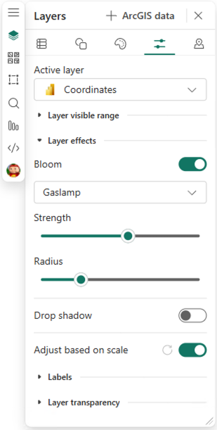
(ArcGIS for Power BI – Layer effects)
Learn more about how to add layer effects to your ArcGIS for Power BI visualization from the Layer properties tab.
Streamlined Guest Consent Workflow
A new integrated consent experience via Microsoft Entra ID to support and monitor usage for guest access levels. To continue providing high-quality ArcGIS services for guest users, the visual now prompts for permission to connect with Microsoft Entra ID.
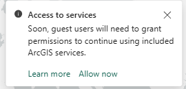
(ArcGIS for Power BI – User consent toast message)
Learn more about the Consent for ArcGIS services in Power BI.
Quality of life updates:
Reset Map Orientation
Map orientation controls have been updated to include a Reset map orientation button, allowing for more streamlined navigation. Once a map has been rotated, users can instantly return to a North-facing view with a single click. This enhancement provides greater control and efficiency when exploring spatial data from different angles.
Learn more about how to Navigate a map.
Join Layer Visibility
Improved consistency for guest users viewing public reports. Anonymous viewers can now view multiple public Join layers without signing in, ensuring data parity with standard public ArcGIS layers while maintaining restrictions on editing capabilities.
Bug fixes:
- Hierarchical Layer Display: Resolved an issue where sublayers and parent layers were displayed at the same level in the Feature Information pane. The Selectable layers dropdown now correctly reflects the layer hierarchy, providing a clearer and more intuitive navigation experience.
- Symbology Stability for Filtered Reports: Fixed a bug where symbology would break when opening a report with a predefined filter applied to joined data. Symbolization based on fields from joined tables now persists correctly, ensuring a consistent visual representation upon loading.
- WFS Layer Integration: The process has been optimized to ensure WFS layers are successfully added and correctly rendered within the visual.
- Embedded Report Validation Check: Fixed an error where a "blocking page" incorrectly appeared in embedded reports despite validation checks passing.
As always, we value your feedback and are committed to making ArcGIS for Power BI better with each release. Your suggestions help guide our improvements, and we are excited to bring you these updates to enhance your mapping experience. Please feel free to share your ideas or if you find anything broken or does not make sense.
Stay tuned for future updates, and we look forward to hearing more from you!

