
ArcGIS for Excel 2026.1.0.0.63 introduces significant enhancements to symbology options, a new analysis tool, Find Closest, as well as important improvements to the sign-in user interface, and expanded support for additional field types.
New features
The Find Closest tool determines proximity between input features and nearby features by using either linear distance or designated travel modes for measurement.
Note: This tool consumes credits, and the Network Analysis privilege is required to run the tool using a travel mode.
In the example below, we have Walgreen store locations for the different counties in Missouri. We want to find the closest stores to each county that offers a drive-thru option.
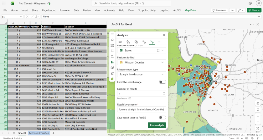
The analysis is running...
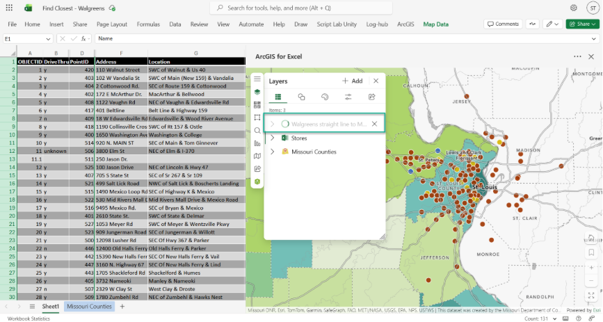
The results are shown below, and clicking on the pop-up will reveal that Store 411, which offers a drive-thru option, is approximately 2.44 miles away or the closest store in a straight line to St. Louis City.
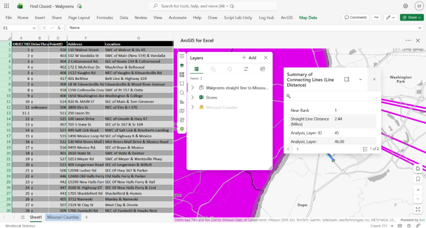
The output result is a hosted feature layer.
Enhancements
- The sign-in process is seamless and efficiently utilizes Microsoft integration.
- There is now support for large integer field types when editing geometries. Use this type when using numbers that are outside of the supported integer field range. See Add field and Best practices for additional information.
- The ID columns in Excel layers are now aligned with the formatting standards of ArcGIS Online.
- The pop-up window includes a Select Row option, enabling you to choose the related row in the Excel worksheet for the map feature.
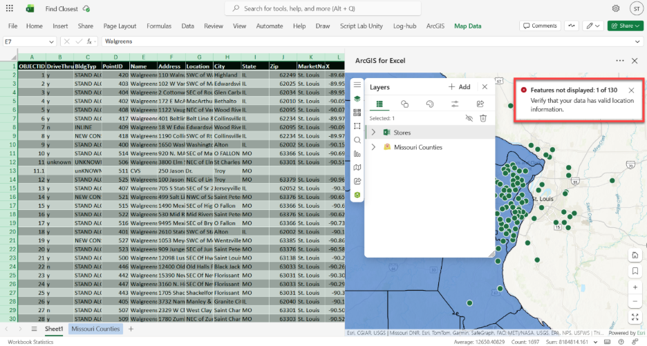
- Errors are now clearly shown failed geocoding and the count of successfully geocoded records is reported.
Fixed bugs
- BUG-000184448 ArcGIS for Excel map does not appear when project is saved, closed, and reopened.
- BUG-000184455 Error indicating the basemap is unavailable or has been deleted from the server when using a service that includes a related table.
- BUG-000179040 ArcGIS for Excel map does not close.
- BUG-000179911 The ArcGIS for Excel side bar opens with every cell click in the web browser version.
- BUG-000178016 Using a macro to apply filters to multiple sheets in ArcGIS for Excel will only filter data from the last sheet that is displayed on the map.
- BUG-000182799 After reopening an ArcGIS for Excel file, users are asked to sign in again—even if they chose “Keep me signed in” as a guest via the panel.
- BUG-000180078 Editing geometry in ArcGIS for Excel fails and returns the error message "Unexpected error editing attributes: Input feature does not have an object id".
- BUG-000183523 Selecting the 'Keep me signed in' option is ignored when reopening the Excel file.
Quality of Mapping
The user interface has been enhanced to be more intuitive and user-friendly. Translation and localization concerns have been resolved, the ArcGIS Ribbon functionality has been improved, and improved error messaging has been updated.
Till next time
Please explore these enhancements and share your feedback. My office is open, so feel free to send success stories to scardoza@esri.com.

