Hello,
We recently saw that Hennepin County updated their imagery service, upon trying to add to our existing Web Map that consumes these county services we ran into an issue. It appears two layers are not playing nice together, but we're unclear why since they're both in the same coordinate system as they were before and worked properly:
Basemap we're using- https://trpd.maps.arcgis.com/apps/mapviewer/index.html?webmap=5505ebdfdb3a49ea87ccbe469d1bc93f
2024 Hennepin County Service-
https://gis.hennepin.us/arcgis/rest/services/Imagery/UTM_Aerial_2024/MapServer
New 2025 Hennepin County service we're trying to add (and replace the respective 2024 one)- https://gis.hennepin.us/arcgis/rest/services/Imagery/UTM_Aerial_2025/MapServer
When adding the 2025 layer we see this error message:
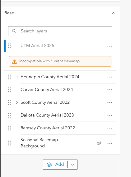
This is a curious thing, because the 2024 layer is in the exact same coordinate system and has had no issues in this map over the last year:
2025: 26915 (26915) LatestVCSWkid(0)
2024: 26915 (26915) LatestVCSWkid(0)
Upon narrowing it down further, it appears the 2025 Hennepin imagery is not playing nice with the Scott County layer-
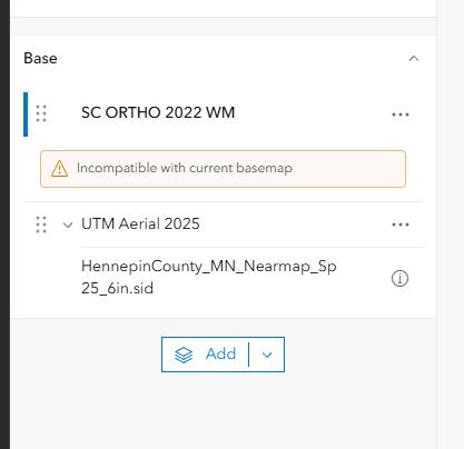
Since nothing has changed between the 2024 and 22025 Hennepin County Imagery, can someone explain why all of a sudden these are being flagged as incompatible?
Thanks so much,
Amanda Huber


