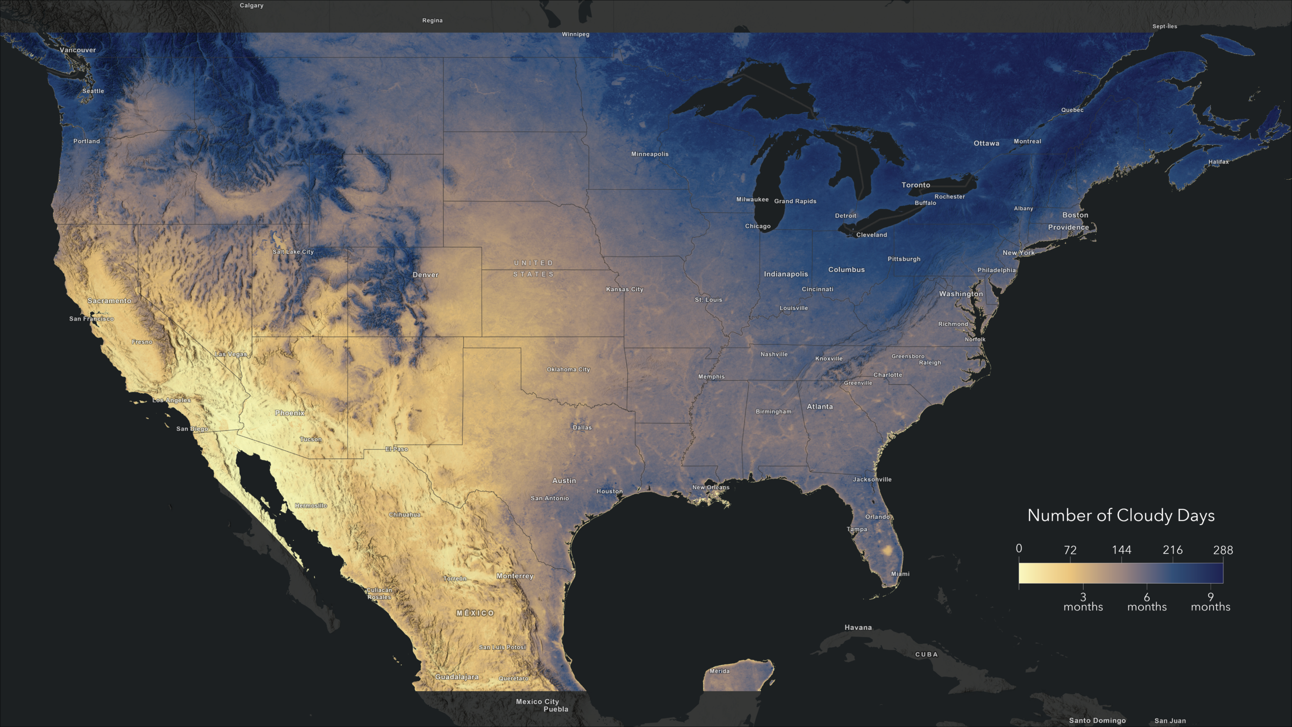
USA Cloud Cover Days is now available in the ArcGIS Living Atlas of the World, makes it easier than ever to integrate cloud cover information into your GIS workflows. This new imagery layer, derived from NASA’s Moderate Resolution Imaging Spectroradiometer (MODIS), provides the average number of days per year with cloud cover for the contiguous United States (CONUS) and portions of Mexico and Canada. With a 500-meter cell size, this data offers the spatial detail necessary for regional analyses in diverse environments.
To learn more about this layer, visit this full article by Raf Antwerpen
Signed in members can post, follow updates, and more. New here? Register a free account.
Find useful guides, FAQs, and documents to help you navigate and make the most of Esri Community.