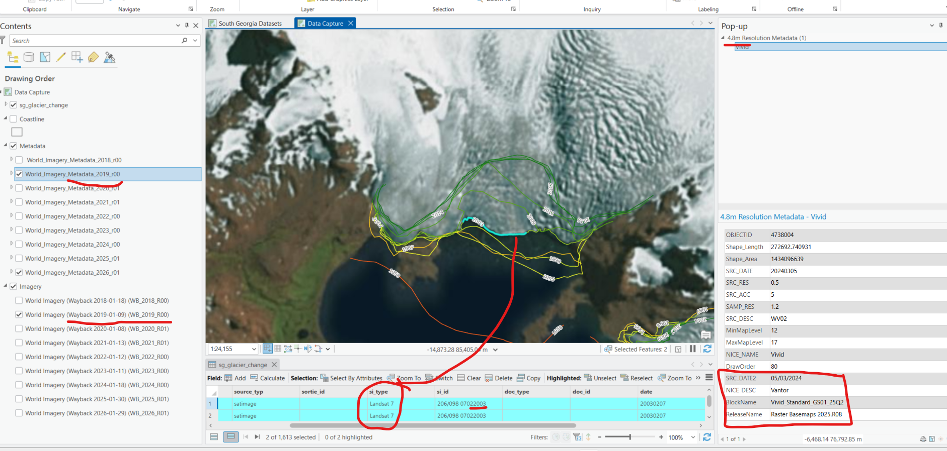
I'm accessing wayback imagery to update a dataset of glacial fronts on South Georgia. ArcPro and the wayback imagery offer a convenient dataset to digitise against, but ONLY if you know the date of the image.
Hence I also access the equivalent wayback metadata for the same release of the imagery.
Now I know and expect some imagery I see is actually from a few years earlier and that world imagery has yet to update with new imagery, this make sense and I think something acceptable.
It's when it some how reports the future that I am highly suspicious! It undermines the confidence of what I am actually viewing. Can someone from the esri imagery team explain why I am seeing what I see below?
I have the 2019 (r00) turned on along with its equivalent 2019_r00 metadata. I have the historic glacial front dataset showing part of a 2003 edge selected. The 2003 data was captured using landsat 7. Note that the 2003 edge aligns wonderfully with the wayback imagery of 2019.
Now my small brain is telling me that the world imagery of 2019 had not updated and therefore is showing 2003 images. That would make logical sense, except if you look at the pop-up on the right the metadata is reporting a 2024 image, 5 years into the future?