D: So, Jen – I’ve heard you’ve been thinking a lot about waffles lately. Care to elaborate?
J: I was eating waffles while thinking about how to design GIS workflows, as one does, and I realized that a common issue I see people make is that they do not think about the waffle.
D: (thinking) …..Where is she going with this?
J: When you go to make waffles, you know what your end goal is: waffles. You know that to get to waffles, you need certain ingredients and tools. I would hazard to say that it is very rare to throw ingredients together without an end goal in mind and end up with waffles.
A common trap I see people fall into when designing GIS workflows, is that they focus on their workflow too linearly and work in a step-by-step manner, hoping to end up with waffles without planning for waffles.
D: Ah! It’s a metaphor!
J: Yes, the most delicious of metaphors. That’s right, I can read minds!
A workflow might entail field personnel collecting some data, which is then sent to some analysts who enrich that data and transform it into something else. Data leads then use that transformed data to do some quality checks before presenting it to stakeholders.
It is very easy to start with the field personnel and create a Survey123 form that collects the data that they care about. Once that’s done, the solution designer will then go to the analysts and address their needs. The same will then happen with the data leads, and then finally we get to the stakeholders. By the time the workflow makes it to the stakeholders, a lot of decisions have been made that will ultimately decide what the stakeholders receive. To meet the needs of the stakeholders, the solution designer might have to go back and redesign their created workflow.
 This workflow didn’t keep the whole picture in mind, meaning the final result missed the mark.
However, if the solution designer has a solid understanding of the end goal, they can make informed decisions throughout the entire workflow design process.
 This workflow thought about the waffle at every step of the process and made decisions that met everyone’s requirements.
D: Great - now I’m hungry!
But, I have to admit, the waffle metaphor makes so much sense to me. It’s really important to “start at the end” sometimes when you’re designing a GIS solution, especially if it involves multiple stakeholders and user groups who may muddy the waters about the end goal. In a GIS web app context, the ‘ingredients’ for our waffles are usually our data, and any supplementary tools used to collect and enrich that data.
In order to avoid a sticky situation, I like to start a solution design by explicitly asking the end user of an application a few things – what questions do we want this tool to answer, and how do we want to communicate those answers (i.e. the map/app/visualization design). That way, we can make sure that the data, automations, and user touchpoints of the workflow all work in tandem to produce the desired end result for a final application.
J: Exactly!
D: So, let’s really drive this idea home with a silly example – Jen and I decided it might be nice to have an Experience Builder app that showcases different user-submitted waffle recipes (there’s more than one way to make a waffle, but that’s a conversation for another blog…).
J: I don’t know, we have hit the three pages of intro text that online recipes are contractually obligated to have. Maybe this is our first step to culinary fame and fortune.
(Looks at Dylan’s recipe) ….. Or maybe we should stick to GIS.
D: We decided early on that our key functionality for this app would be to display up to nine ingredients in a waffle-shaped grid, and the ability to select a Waffle Connoisseur from whom you’d like to see a recipe. So, we designed a data schema with this in mind – the app is driven by a Hosted Feature Layer that stores our Connoisseur information, with a related table of Ingredients. Because we knew that we wanted to present the recipe in a waffle-shaped grid, we set a repeat-count that limits the user to 9 related records.
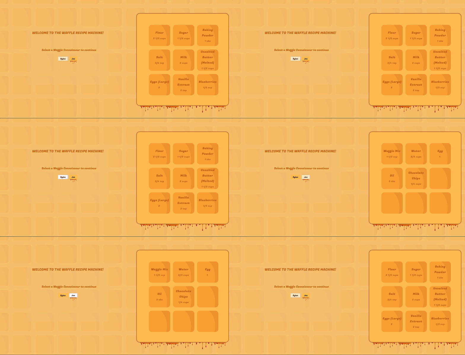
The Waffle Recipe Machine…because, why not?!
D: In short, we knew that we wanted to make a waffle, and we chose our 'ingredients' accordingly.
Challenge
Design a workflow by starting at the finish. Bonus points if it’s food related.
Check out the rest of the Configure It Out series for more tips, tricks, and discussions on creative problem solving and out of the box thinking in ArcGIS.
