I am trying to automate a boundary adjustment workflow in ArcGIS Pro and could use some help. Not even sure if this is possible.
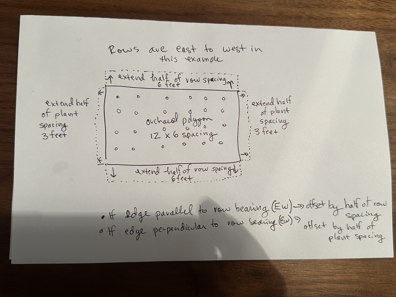
I have polygons that represent orchards, but the edges were surveyed at the tree line and the tree canopies go past that. I am trying to extend the edges of each polygon depending on the row or plant spacing of the orchard; what I think is an anisotropic buffer (uneven buffer on all sides). My polygon has row spacing, plant spacing and line bearing (the angle of the rows of the orchard) attributes.
If the edge of the polygon is parallel to the row line I want the edge to be pushed out half of the row spacing. If the edge of the polygon is perpendicular to the row linen I want the edge to be pushed out half of the plant spacing.
I have tried custom arcpy scripts and affine transform + buffer methods, but they break on irregular polygons because small vertices and corner reconstruction change the offset distance. Is there a recommended workflow in ArcGIS Pro for something like a directional / anisotropic buffer where the offset depends on edge orientation?
Here is an attempt at a drawing explaining the problem: