In February 2026, I had the privilege of serving as a Student Assistant at the annual Conference in Washington D.C. Surrounded by GIS professionals across federal agencies, private industry, and academia, I found myself immersed in conversations that reflected the true power and potential of geospatial science.
As a current Geographic Information Science (GIS) student at Arizona State University and a former Geospatial Intelligence (GEOINT) Imagery Analyst in the U.S. Army, this experience felt like a convergence of my past and future. My background with ArcGIS, imagery analysis, and intelligence production gave me a strong technical foundation but this conference expanded my understanding of how GIS is applied at scale across diverse federal missions.
More Than a Role: A Front-Row Seat to Innovation
While my primary responsibility was assisting with guest registration, handing out swag bags and welcoming attendees, the real reward was exposure. Being stationed at the entrance allowed me to observe conversations unfolding organically—federal analysts discussing workflows, scientists exchanging insights on satellite data, and program managers exploring collaborative solutions.
My favorite part of the entire experience was listening. By attending Special Interest Groups during the conference, I learned how professionals from environmental agencies, defense sectors, emergency management offices, and space organizations are applying Remote Sensing in uniquely innovative ways. There is something incredibly powerful about hearing professionals speak candidly about their work, the challenges they face, the innovations they are testing, and the breakthroughs they are striving toward. Each conversation revealed a different lens through which GIS is used to solve real-world problems—from climate monitoring to disaster relief to national security.
What stood out was the diversity of application.
In environmental agencies, Remote Sensing supports wildfire monitoring, water resource management, and land cover classification. In defense and intelligence communities, it informs situational awareness and strategic planning. In infrastructure and transportation sectors, it supports asset management and urban growth analysis. The same foundational technology can inform drastically different missions depending on how it is processed, interpreted, and applied. The tools may be similar, but the applications are expansive. As someone who once exploited satellite imagery to support overseas combat operations, seeing Remote Sensing applied to climate science, ecosystem monitoring, and disaster mitigation broadened my perspective.
GIS is often viewed as a technical discipline but in those conversations, I saw its human dimension. I heard the passion behind scientists discussing advancements in satellite content. I heard the urgency in emergency managers describing how spatial data accelerates disaster response. I heard the curiosity in analysts exploring how artificial intelligence can enhance geospatial workflows for a variety of applications.
It reinforced a realization I have had since my time in GEOINT: GIS is not just about maps or imagery. It is about mission.
 Elodie Macorps (NASA Goddard) presenting on the NISAR mission.
Deep Dives Into Imagery and Remote Sensing
As a Student Assistant, the greatest benefit of all was the opportunity to explore the conference after my assigned shift. During this time, I took advantage by attending technical sessions focused on remote sensing and imagery topics such as reality mapping, lidar, 3D capabilities, multidimensional imagery, and the next generation of satellite content—all topics I am deeply passionate about. These sessions highlighted emerging technologies, evolving workflows, and real-world applications that reinforced why I chose this field.
One of the standout sessions was attending the NASA Town Hall: New Sensor Data for GIS Users, where Esri users, program leads, and government leaders connected with NASA and Esri representatives in a large group interactive forum.
I particularly enjoyed learning about ongoing NASA missions including:
- EMIT (Earth Surface Mineral Dust Source Investigation) – Mapping mineral dust sources to better understand climate impacts.
- PACE (Plankton, Aerosol, Cloud, ocean Ecosystem) – Monitoring Ocean color, aerosols, and clouds to improve climate and ecosystem models.
- NISAR (NASA-ISRO Synthetic Aperture Radar) – Measuring Earth’s surface changes with unprecedented precision.
Sitting in that session, I felt the same excitement I experienced when I first learned to interpret imagery as a young analyst. Remote Sensing is more than observation—it is interpretation, prediction, and insight. It transforms raw spectral signatures into meaningful intelligence about our planet’s dynamic systems. As someone fascinated by how satellite technologies transform raw data into actionable insight, this session was a defining highlight.
A Message From Jack Dangermond
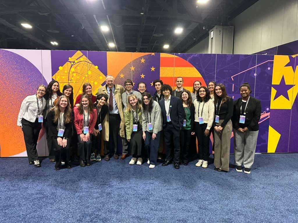
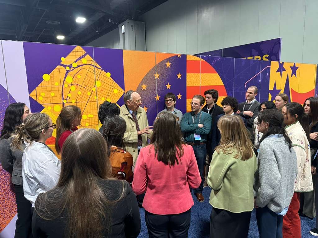
One especially memorable moment was meeting Jack Dangermond, the founder of Esri. He graciously took time to speak with the student assistants, sharing a heartfelt story about time he spent with his close friend, Jane Goodall, in the days before her passing. He left us with a simple yet powerful message: whatever path you choose, make sure it brings you happiness.
His words stayed with me throughout the remainder of the conference. As I reflected on them, I realized that I have never met anyone who built a career in GIS who did not genuinely love what they do. Passion seems to be the common thread that runs through this field. It is the driving force behind innovation, collaboration, and the unique energy that makes the GIS community and events like FedGIS so inspiring and impactful.
The Power of Networking and Shared Passion
Beyond the technical knowledge, the networking opportunities were invaluable. I connected with GIS professionals from multiple federal agencies, private firms, and nonprofit organizations. Many were generous with their time, offering advice about career paths, graduate education, important skills for success, and answering questions about workflows and emerging technologies. Some shared insights into how they transitioned from technical roles into leadership positions or moved laterally from one mission to another (e.g. national security to humanitarian efforts). There are many opportunities for this throughout the conference, but undoubtedly the best networking opportunity is the Networking Social held at the Smithsonian Portrait Gallery.
Equally meaningful was meeting fellow students from universities across the country. The Esri YPN Social provided the perfect opportunity to exchange stories about coursework, research interests, career goals, and internships. It was motivating to be surrounded by peers who share the same curiosity and drive to push the boundaries of spatial science. There was a strong sense of community—one that extended beyond institutional affiliations. If you are interested in becoming a member of Esri's Young Professional Network, you can learn more about the program here.
Reflection: Insight, Inspiration and Direction
Serving as a Student Assistant gave me more than a conference badge. It gave me perspective. It allowed me to step back and see where I fit within the larger geospatial ecosystem, and where I’d like to go in the future. I am not just a student learning software workflows. I am a young researcher, part of a community shaping how spatial information plays a role in national and global decisions.
This was far more than a volunteer experience, it was a catalyst for growth. It strengthened my confidence in my technical background as a former GEOINT analyst, broadened my perspective on how GIS and remote sensing are shaping federal initiatives, and reaffirmed my passion for remote sensing technology and spatial analysis.
Washington, D.C., is often described as the center of policy and governance. During the conference, it also felt like the center of geospatial innovation. Standing in that space—between my military past and my academic future—I felt certain of one thing:
I am exactly where I am meant to be.
And I am more motivated than ever to contribute to the evolving story of GIS.
A Special Thank You
A heartfelt thank you to Joe Galarza and Xochitl Garcia for their kindness and professionalism throughout the entire process in preparation of and during the conference. Their engagement and dedication to making this a positive experience for all the student assistants was truly exceptional. I am so grateful for this experience and everyone who made it possible.
If you are interested in applying to be a student assistant, refer to the Student Programs webpage. You can also view more details here on this blog post.

