Idea:
In ArcGIS Pro you are able to use Proportional symbology with units to make that symbol appear that size on the map. I would like to do the same thing in ArcGIS Online Map Viewer and connected apps like Field Maps/QuickCapture.
Tests/Examples:
Here is an example of what I want to do in ArcGIS Pro using a line with a field called TreatmentBuffer with a value of 20. Using Proportional symbols and setting units to US Feet I am able to make a symbol that is 20ft wide.
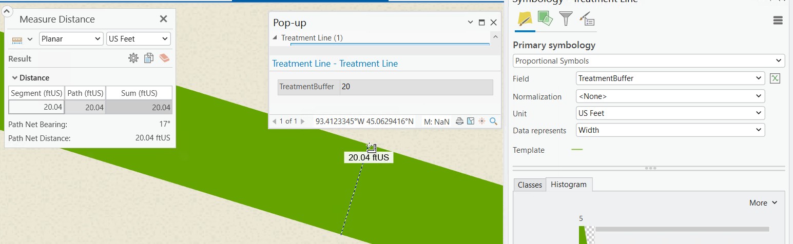
This capability is not currently possible in ArcGIS Online even if you edit the web map via ArcGIS Pro. The closest thing in ArcGIS Online is using the symbology "Counts and Amounts" but there is no way to tie it to a unit of measure and there is also a width limit (in pts) for symbology in general that makes it hard to try to replicate the same visual.
Use-Case:
I have field staff that are driving vehicles with boom sprayers. I would like to setup a Field Map or QuickCapture map for them that captures what they are spraying and providing them a visual of what they have already sprayed on a tablet. This data will eventually need to become a polygon as well for record keeping. As the spraying takes place on either side of them while driving, collecting as a polygon does not work with them in the middle. My idea is to have them collect with a line that is symbolized to be the width of their spraying to be a visual indicator to the driver where they have sprayed then using buffers to create the polygon after the fact.


