Hi all,
I am using the wonderful Esri USGS Historical Topographic Maps imagery layer from the Living Atlas. I thought it was all topo maps but I am surprised to find aerial imagery in here. Is there a way I can filter on one of the fields to only show Topo maps/Not show aerial photos?
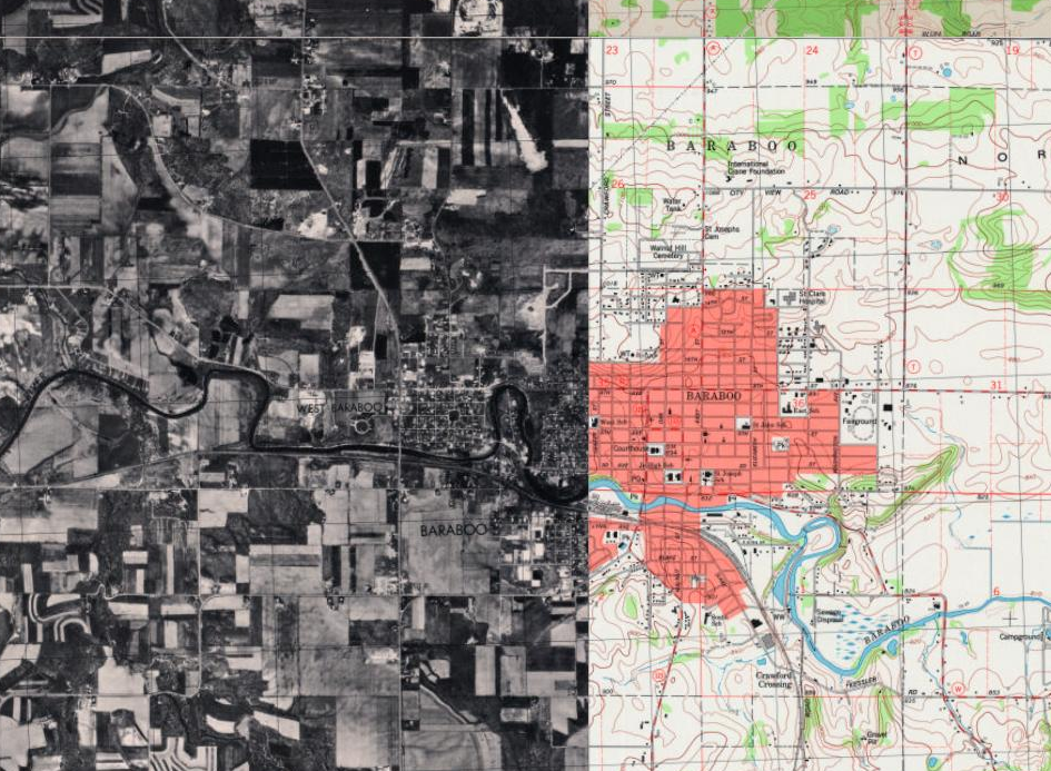
I thought maybe the "Aerial Photo Year" field but the topo shown has a value in that field as well. And the field "Orthophoto" is blank where aerial is.
Thank you,
A

