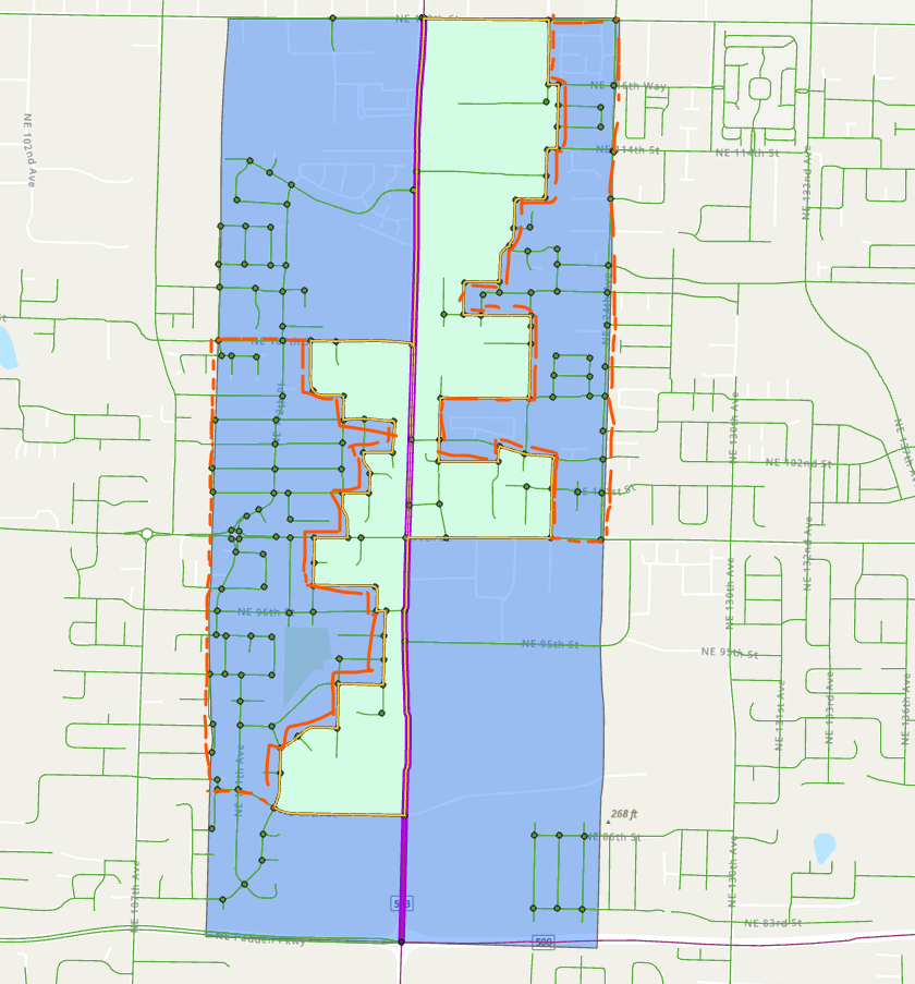
I have a geospatial problem that I can't seem to figure out, and I'm wondering what combination of geoprocessing tools, if any, could get me the result I need. Also open to any suggestions outside of the box for how to solve this.
I have roadway segments (lines), road intersections (points), and "adjacent block areas" (polygons). For all parts of the roadway segment that are touching an adjacent block area, I want to use that adjacent block polygon for my calculation. But where there is no adjacent block, I want to use a 2000' buffer. Either way, I need to calculate the number of intersection points inside my selected polygons.
In the image below, the green areas are the adjacent polygons and the blue area is just a 2000' buffer. The areas outlined in the orange dashed line are what I'm trying to remove from the analysis. I need to calculate the number of points that touch the green polygons PLUS the number of points that touch the 2000' buffer but only where there is no green polygon for that part of the roadway, looking at the left and right sides of the road separately.