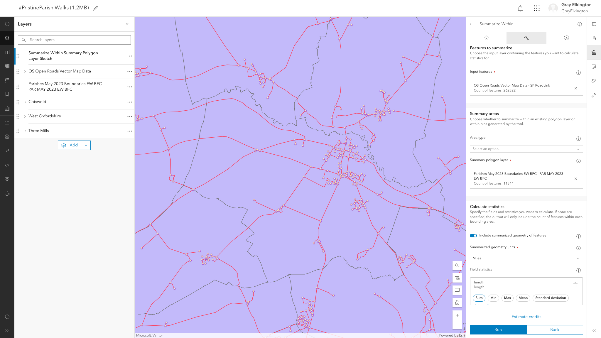
I'd like to to summarise the road lengths within the parish of Burford.
I'm logged into ArcGIS Online's Map Viewer and using the Summarize Within tool:
- Features to summarize: OS Open Roads Vector Map Data - SP RoadLink (Burford is within the SP Area)
- Summary areas: Parishes May 2023 Boundaries EW BFC - PAR MAY 2023 EW BFC (Covers England & Wales)
- Calculate statistics:
Summarized geometry units - Miles
Field statistics - length > Sum - Environment settings:
Processing extent - Full extent
Obviously, this gives me results for the entire SP area. The other Environment settings are also not what I want.
So, how do I clip the features within Burford to Burford's boundaries?
After 48 hours of trying and failing, any help greatly appreciated!




