Hello,
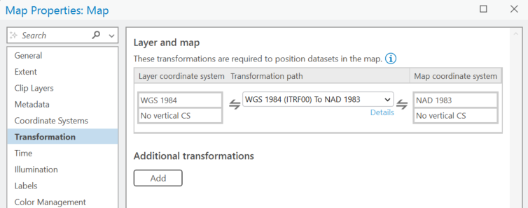
Question: Why does the geographic transformation involving the 1st layer get listed in the Map Properties> Transformations section? (see below for example): I'm simply adding a layer in NAD 83 to a brand-new ArcGIS Map set to WGS 84 (Web Mecator, auxiliary sphere, WGS 1984)
By the way, I understand what a geographic transformation is, and the concept of projection on-the-fly.
But I may not be fully understanding this specific ArcGIS behavior, because my knowledge is that:
- The 1st layer added does NOT need to be projected on-the-fly because it simply resets the Map Display coordinate system -- so that all other layers added "THEREAFTER" get projected (on-the-fly) to this coordinate system
- In other words, I would expect to see Geographic Transformations to be listed only "AFTER" that.
...What am I missing?
The only thing I can think of that could be the reason the 1st geographic transformation gets listed is, perhaps, because the Basemaps already in Contents (on the map) get re-projected on-the-fly?
...Is that the reason?