Hello @RobertKrisher and all,
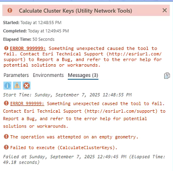
We encountered an error while running the Calculate Cluster Key tool: "Operation was attempted on empty geometry." In our case, the UNM implementation was utilising a custom coordinate system.
We then tested the tool on Water Distribution UN Foundation gdb, which uses Esri coordinate system (NAD 1983 StatePlane Illinois East FIPS 1201, US Feet), and the tool functioned as expected. However, after we changed the spatial reference of the Water Distribution UN Foundation gdb to the same custom coordinate system, it hit the same error.
Was wondering if this tool does not support the UNM implementation in custom coordinate system or if there is something i missed?
Our goal is to improve UNM performance in any way possible as it is noticeable that UNM tends to render slower in web app level. Any suggestion on how to improve UNM performance is very much appreciate as well!
Thanks in advance!




