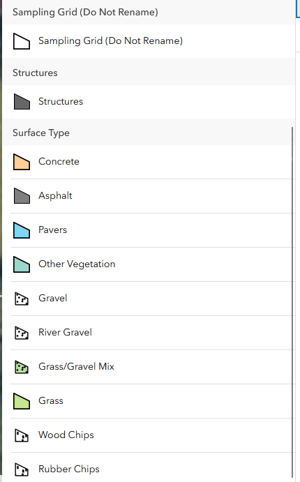
I have a web map set up to collect data in the field. I have several service views that each have multiple layers within the view. I have also brought in some layers multiple times with different filters and symbology in order to create unique features that a field team can map. I have set up forms with custom scripts and templates to achieve this and this works great on the web map, but does not translate well to the Field Maps app. See the screenshots attached. For some layers in the map it works fine, but for others I get results like the one below.
Create features option in web map with the correct symbology:
Create feature options in Field Maps with the incorrect symbology for sample grid and structures:
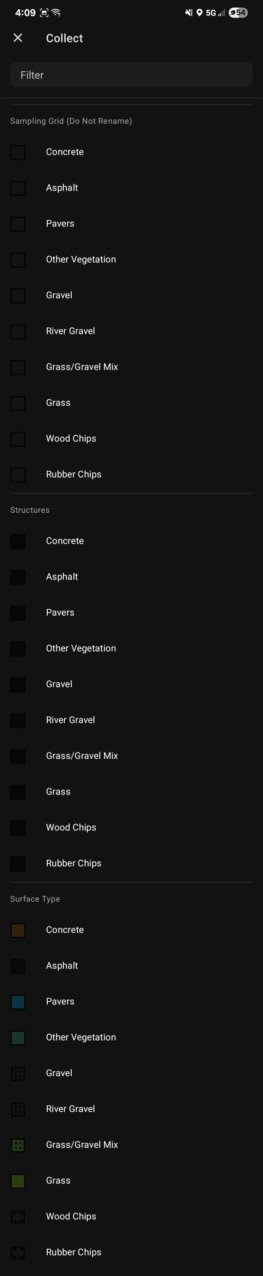
The "Sampling Grid" , "Structures", and "Surface Type" layers in the map come from the same layer in the same view and are only differentiated by a filter and symbology set in the web map.
The views are a 1:1 of the feature service, with only 1 filter before being added to any web map.
Is this a bug? Or should I be setting up the view differently to achieve my desired results?

