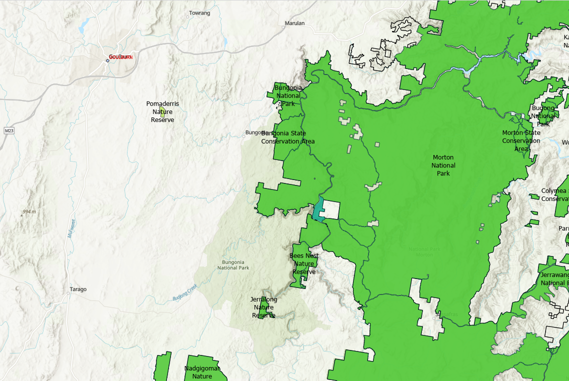
I noticed a discrepancy between an administrative boundary in NSW, Australia and what is shown on the ESRI Base maps. ESRI shows Bungonia National Park in on private land that is not mapped as National Park on the NPWS Estate dataset, nor in any government mapping portals. National Parks layer in green on image below. How can I get this resolved?