Hello,
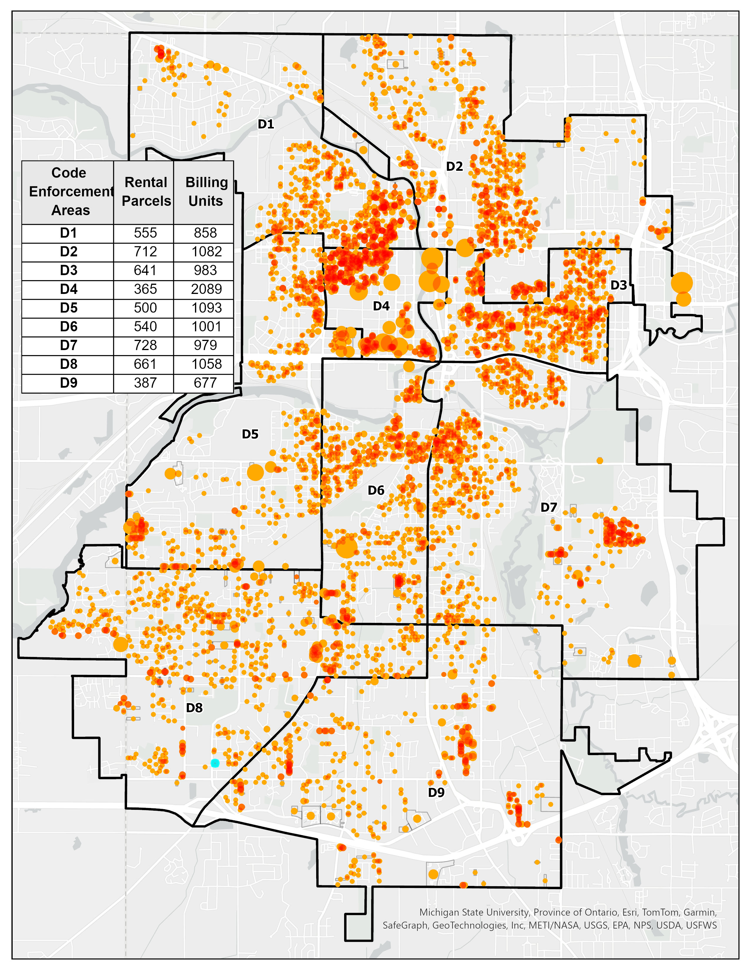
My office is looking to adjust our code enforcement areas for rental properties so that each area is relatively equal. We have a limited number of code enforcement officers and would like to prevent one officer from having to manage nearly 1000 more units (Area D3) than the next. I created the map below using graduated symbols based on the number of billing units in each parcel to create a heat map-style that shows the density of rental units.
Is there a way to redraw the enforcement area boundaries based on an equal number of billing units? Ideally, we'd like to be able to draw a lasso around a group of parcels and see the sum of billing units at a glance so that we can work on the new boundaries at a team meeting.
Thank you!