Hi,
I have a weird problem where Arc will not convert my csv into a shapefile unless I save it into my project folder. I import the csv, check the data types, and run Create Point from XY:
Input Table ozone.csv
Output Feature Class C:\Users\Arya\Documents\ozone.shp
X Field Site Longitude
Y Field Site Latitude
Z Field
Coordinate System GEOGCS["GCS_WGS_1984",DATUM["D_WGS_1984",SPHEROID["WGS_1984",6378137.0,298.257223563]],PRIMEM["Greenwich",0.0],UNIT["Degree",0.0174532925199433]];-400 -400 1000000000;-100000 10000;-100000 10000;8.98315284119521E-09;0.001;0.001;IsHighPrecision
Traceback (most recent call last):
File "c:\program files\arcgis\pro\Resources\ArcToolbox\scripts\XYTableToPoint.py", line 285, in <module>
", ".join(empty_out_bounds)))
^^^^^^^^^^^^^^^^^^^^^^^^^^^^^^^^^^
File "c:\program files\arcgis\pro\Resources\ArcToolbox\scripts\XYTableToPoint.py", line 271, in xy_table_to_points
arcpy.AddIDMessage("WARNING", 1086, str(e).split("[")[1][:-1])
^^^^^^^^^^^^^^^^^^^^^^^^^^^^^^^^^^^^^^^^^^^^^^^^
File "C:\Program Files\ArcGIS\Pro\Resources\ArcPy\arcpy\management.py", line 6549, in CopyFeatures
raise e
File "C:\Program Files\ArcGIS\Pro\Resources\ArcPy\arcpy\management.py", line 6540, in CopyFeatures
gp.CopyFeatures_management(
File "C:\Program Files\ArcGIS\Pro\Resources\ArcPy\arcpy\geoprocessing\_base.py", line 532, in <lambda>
return lambda *args: val(*gp_fixargs(args, True))
^^^^^^^^^^^^^^^^^^^^^^^^^^^^
arcgisscripting.ExecuteError: ERROR 000210: Cannot create output C:\Users\Arya\Documents\ozone.shp
ERROR 000308: Invalid field type
Failed to execute (CopyFeatures).
Failed script XY Table To Point...
Failed to execute (XYTableToPoint).
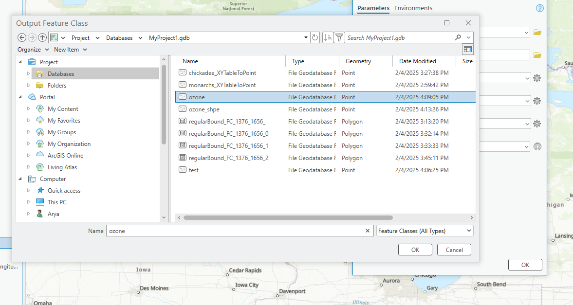
But if I change the output to be stored within the project, it works fine: