Hello,
I am pretty new to working with LiDAR. Right now I have a LiDAR dataset that is unclassified beyond ground and bridges. I want to classify buildings and vegetation as well and I'm find the Classy Building and Classify by Height tools are pretty good. However, I'm running into scenarios where the edges of buildings are getting captured as vegetation, and I'm hoping there are some of you who could either suss out why that is, or point me to some useful tutorials (I've read through much of the ESRI-provided documentation for the tools).
Here's an example of what I mean:
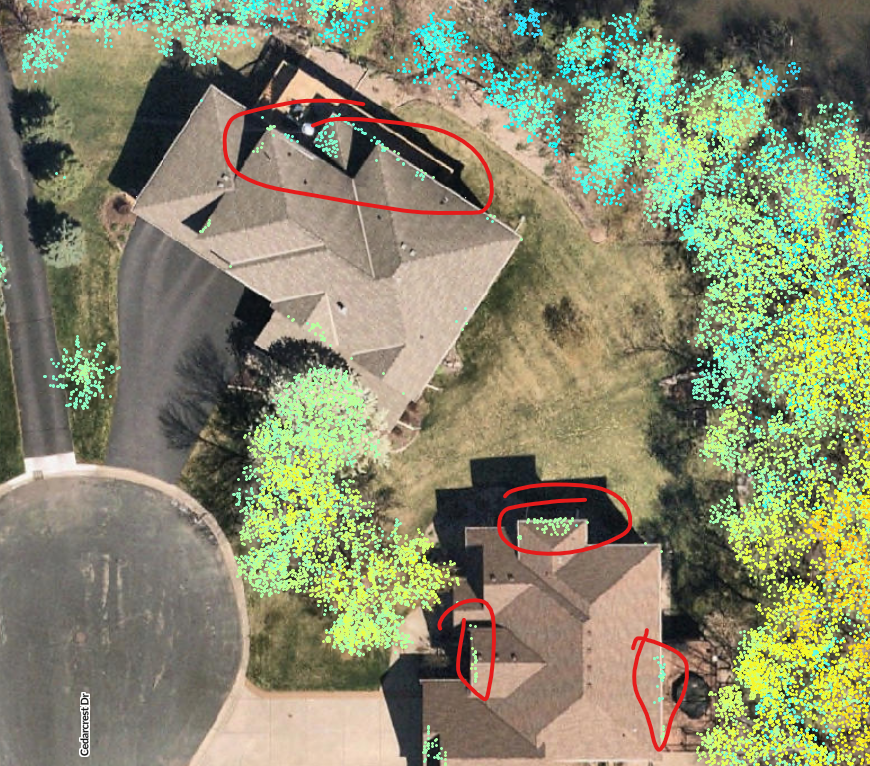
The areas in the red circles are definitely parts of the buildings, but are being classified as medium vegetation. My workflow was first to run the Classify Building tool, and I mostly kept the defaults (2m minimum height and 4 sqm minimum area). That mostly does a good job, and is improved by enabling the classify above and below building options, but even that results in some edge errors (shown above), after running the Classify by Height and keeping the default settings of 5/25/50.
Thanks!


