Idea:
Impose naming conventions on Living Atlas content that require inclusion of the spatial extent of the layer in the name. Something like continent + country abbreviation + State/Province abbreviation + Locality + subject matter. For example: North America-US Roads or North America-US-CA-Los Angeles - Roads. This would allow users to sort search results alphabetically and then and quickly scroll down to their geographic area of interest.
Reason:
It seems like the Living Atlas is now including a lot more local and regional data. I'm not strictly opposed to this, but I really hope that Esri's Living Atlas team will start enforcing some naming conventions so that users can tell what each dataset represents.
For example, a search in Pro's Catalog pane for "Roads" returns results like RoadCenterline and TCT Road Centerline. The former is for the city of Redding, CA, USA and the latter is for Cape Town, South Africa. But users can't tell what the spatial extent is for either layer without clicking through to its item details page. This can get time consuming and frustrating.
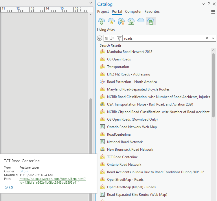
Similarly, those results include a layer called Transportation that is US-based, and a map named National Road Network that is Canadian, but their countries of origin are not obvious from their layer names. I have to hover over each one and deduce from its owner name where the data is from.
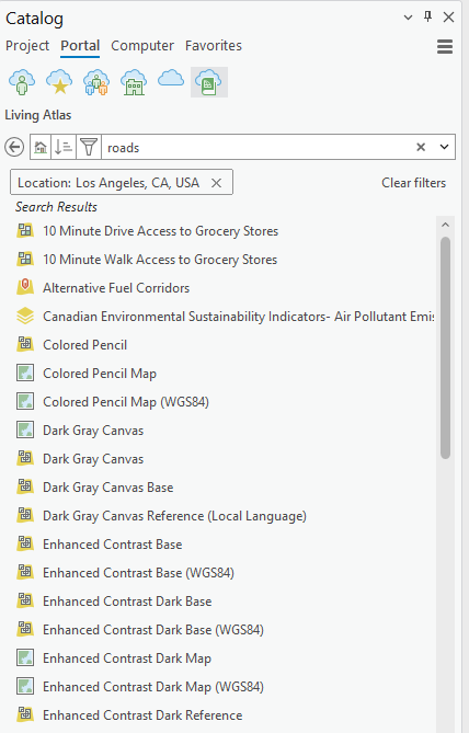
I know there are filters that allow us to subset by Region and Location, but these don't seem to work all the time. Example:
My understanding is that the Living Atlas is supposed to be a curated catalog of authoritative data, and I've found it very useful in the past. Lately, though, it is starting to feel cluttered, unmanaged, and not that different from the rest of ArcGIS Online. I think enforcing some naming conventions would help.
Thanks!




