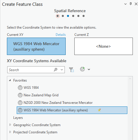
Is there anyway to set the default coordinate system for creating new feature classes. In NZ we only have one coordinate system for the whole country. Well there are heaps - but only one main one. As such I would like it to default to New Zealand Transverse Mercator when I create a new feature class.
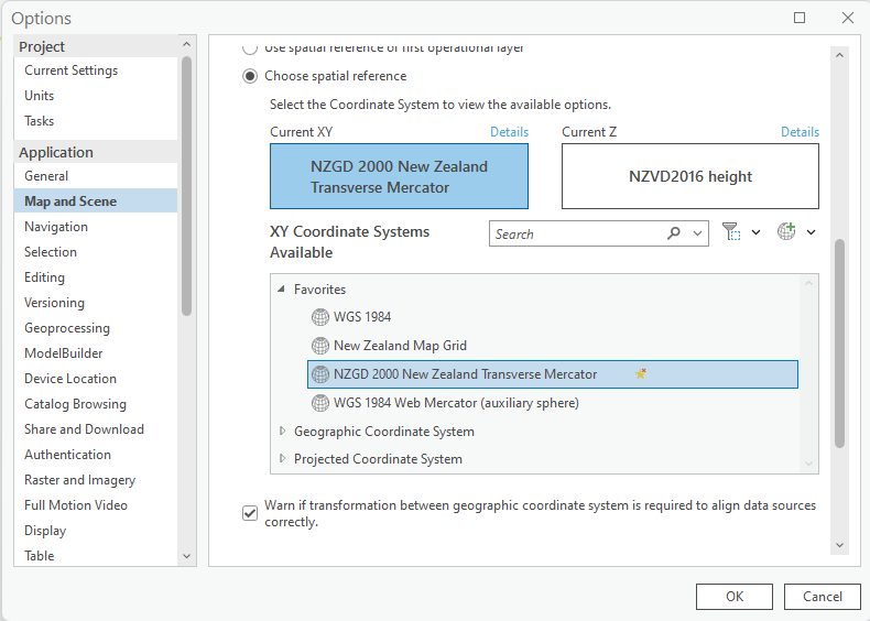
I currently have NZTM set as default for my maps (see below) but this doesn't seem to flow through to the Create Feature Class process. Although I swear it used to. I feel like this has just changed with 3.3.1?
Anyway - if there is a way it would be great if some could point me to it. I can't seem to find anything on Google. I never can it seems these days..... 😞