Hello Esri Community,
I’m reaching out regarding the recent deprecation of the Streets Data Compatibility Pack, and this is in reference to the blog post "Completed the 2024 BA data download. I do not see the 'Business Analyst - Basemap.lyr'". It appears that my earlier post was removed, and I apologize if this resulted in a duplicate topic. I want to ensure I’m following the correct process while trying to find an answer to the issue outlined below.
I’d like to clarify the core issue we’re facing regarding the recent transition from the Streets Data Compatibility Pack to the use of VTPKs (Vector Tile Packages). While we understand that tools like the ArcGIS Vector Tile Style Editor (VTSE) offer customization options, they still do not meet our specific needs. I’d like to outline the critical limitations we’ve encountered:
Zoom-Level Dependencies: One of the most pressing issues is the inability to display detailed roads, cities, and towns at certain zoom levels, as we were able to with the previous Streets Premium dataset. While VTSE allows for some layer customizations, it does not offer the same granular control over visibility at different scales. In our workflows, there are times when we need to toggle detailed roads on and off at will, but this functionality is constrained by zoom dependencies in VTPKs.
Professional Map Presentation: The core of this challenge is that our clients and stakeholders have come to expect professional maps that can show or hide certain details as necessary, with clean and refined visuals. As seen in the attached images (such as Basemap Sample Detailed Roads Local and Basemap Sample Detailed Roads Census), the vector tiles lack the ability to fully recreate the professional appearance we were achieving with Street Map Premium, particularly when displaying road networks.
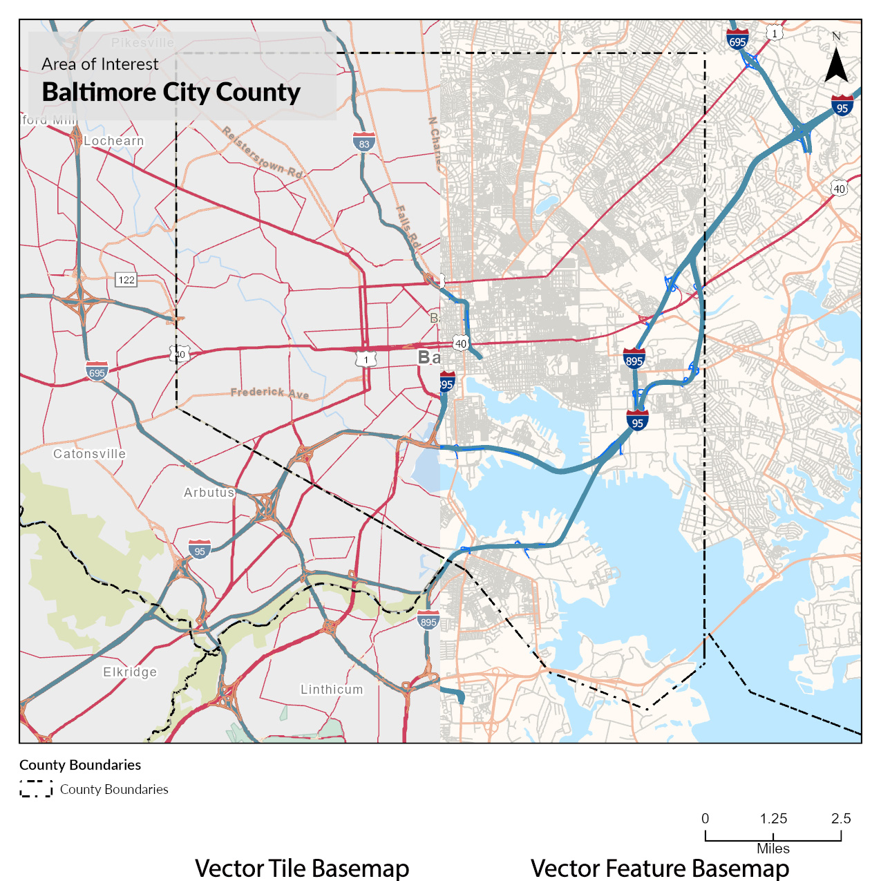
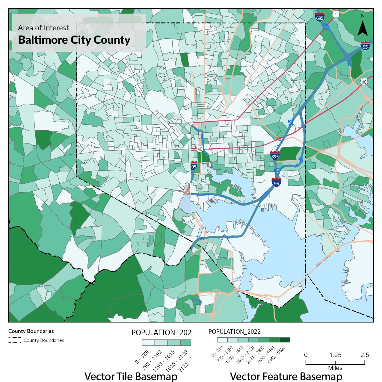
Layer Control Limitations: The flexibility of turning specific data on and off based on presentation needs, which we had with Street Map Premium, is no longer fully replicable in the current system. Even breaking the basemap into multiple layers does not solve the issue when zoom-level restrictions prevent the display of important map details.
Our Ask: Moving forward, we need consistent, replicable solutions to achieve the same level of professional control that we had with the previous setup. This is critical not only for day-to-day mapping operations but also for delivering results that meet stakeholder expectations.
Can Esri provide a clear path or alternative that resolves these visibility and customization issues? Additionally, is there a way to maintain control over zoom dependencies within vector tiles or alternative methods that would provide the same functionality as the now-deprecated Streets Data Compatibility Pack?
We are eager to hear more on how we can implement a solution that will not disrupt our existing workflows and continue delivering high-quality results.

