ArcGIS Pro 3.1.5: What do the green and red points indicate when applying georeferencing?
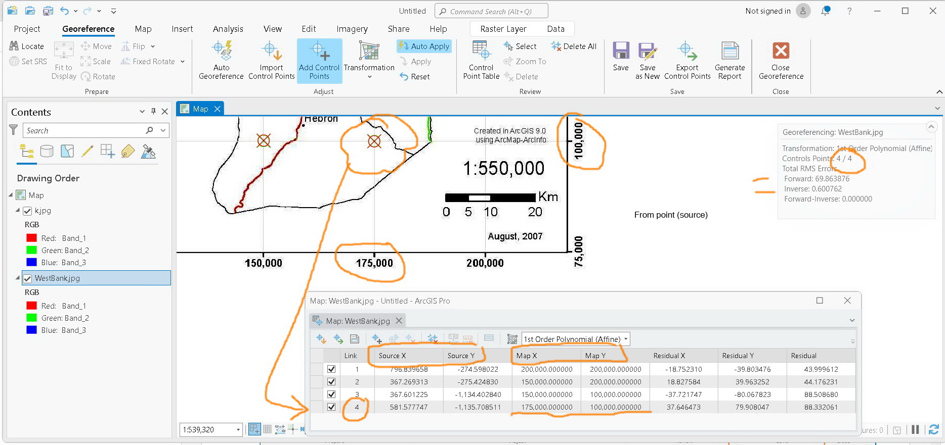
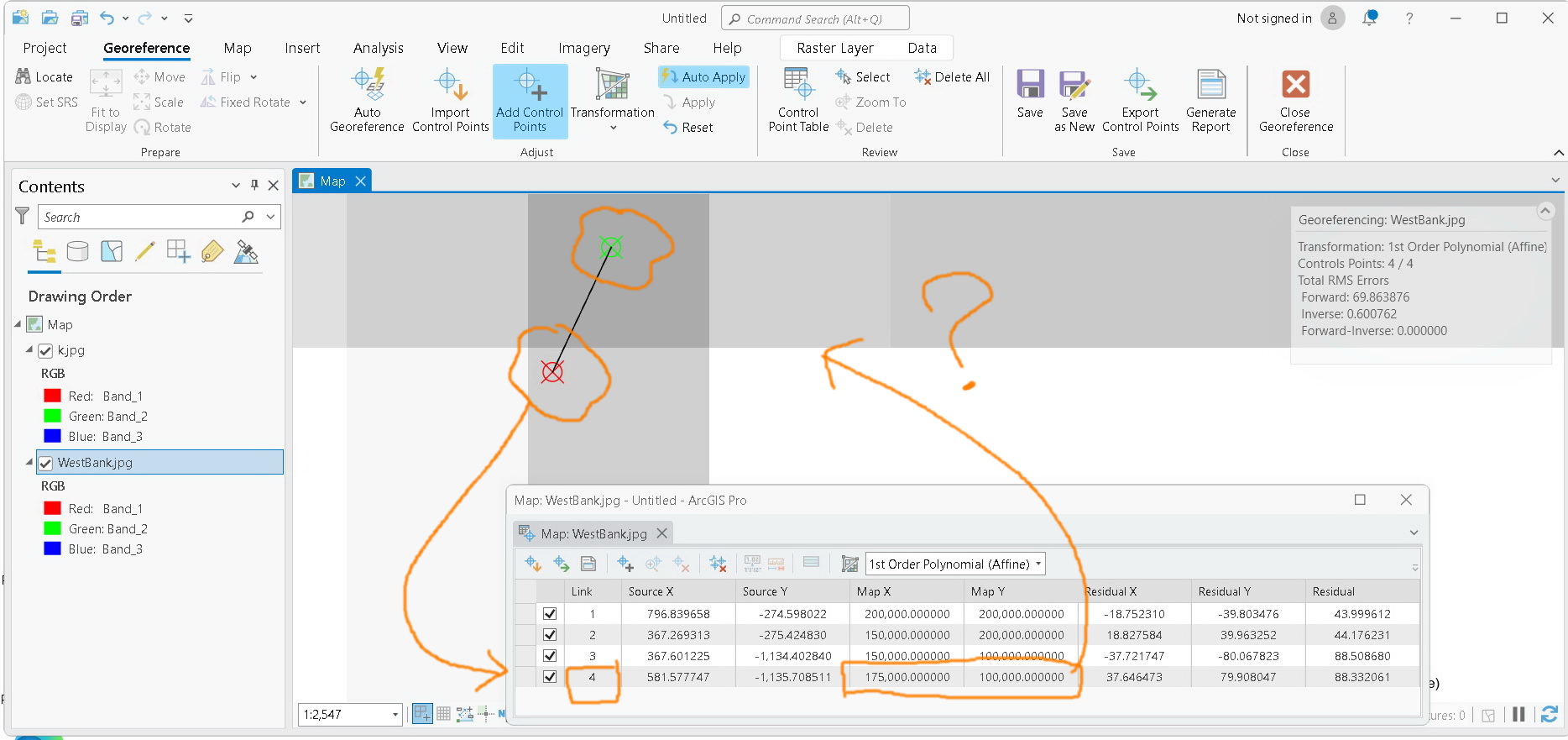
For example, in the screenshot below, point #4 is georeferenced to the target coordinates. Zooming in reveals two points: one red and one green. What do they indicate?