I created a script tool that takes select dimensions from n+1 .kml files and generates a fairly simple point feature class.* Everything functions as intended, but I am unable to figure out how to add content to the tooltips for each field (no descriptive text appears when a user hovers over the "i" next to a field):
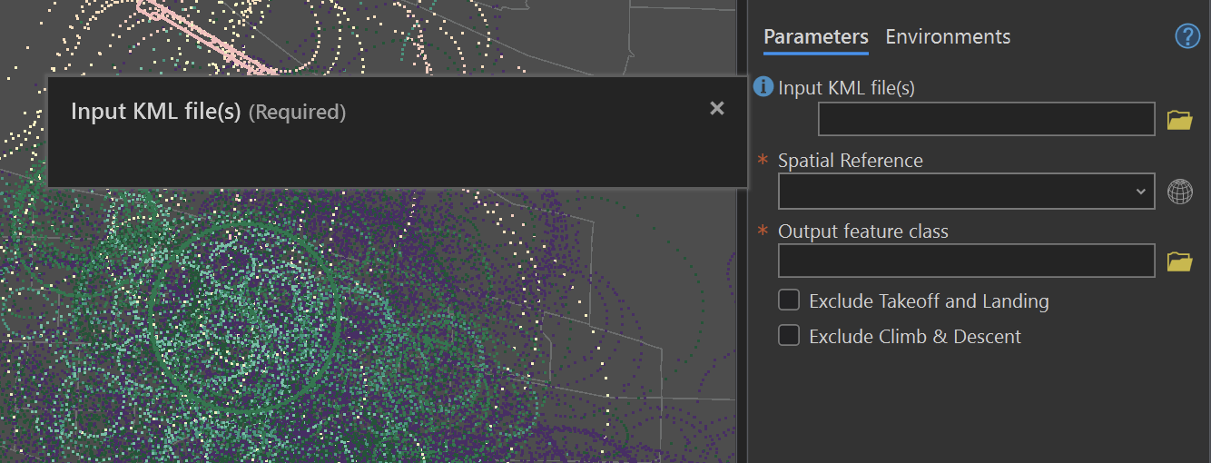
For what it's worth, I am using 3.2.
- Can this be done in the script itself? If so, what's the play?
- If this is to be done through the user interface, where do I go? I can't find anything in parameters, and I don't see anything field specific when I right click the script to edit the meta data.
- Another method?
Thanks for your time!
*tool allows you to transform .kml exports from adsbexchange into a 2d point layer. Retains n-number, timestamp, and altitude as contextual fields while only symbolizing the point with latitude and longitude.




