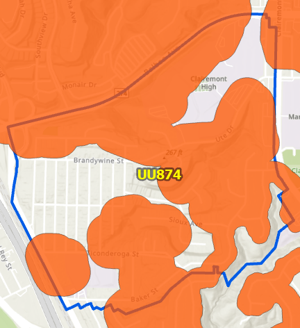
Hi Community,
I am working to update a model. My goal is to find the Percent Coverage of the District Boundary (Blue polygon) that is covered by the High Fire Zone (Red Polygon). Ideally, I would like to add a field to the District Boundary with the percentage coverage ie 50%. The logic will be used in a model throughout the city.
- Previously model ran an intersection ran between the two polygons and divided the High Fire Zone Shape_Area by District Boundary Shape_Area. I might have been in GIS too long, and I don't fully trust the Shape_Area is automatically updated as units are edited.