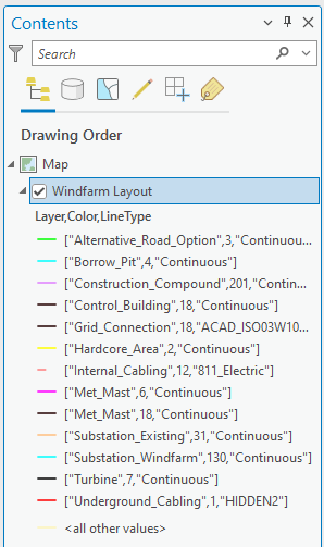
I have been using ArcGIS Pro to convert AutoCAD .dwg files to shapefiles since 2020. These Cad files contain windfarm layouts with the different elements of the windfarm (i.e. turbines, access roads, borrow pits etc.) all on their own layers. The elements are only made up of polylines and circles, no blocks, hatches etc.
Up until now I would use the Add Data tool in ArcGIS Pro to import the Cad file, which would then display all of the layers in the .dwg as individual layers GIS.
I recently updated to ArcGIS Pro 3.2.0, and since then I have been having an issue. I import the Cad file in the same way, but now all of the layers in the .dwg import to GIS as a single layer (see attached image). This is less than ideal as I need the file to import as individual layers. Does anyone know of a workaround for this issue? I have been unable to find anything to solve it.
Thanks