Hello,
I have downloaded some data from GEBCO 2023
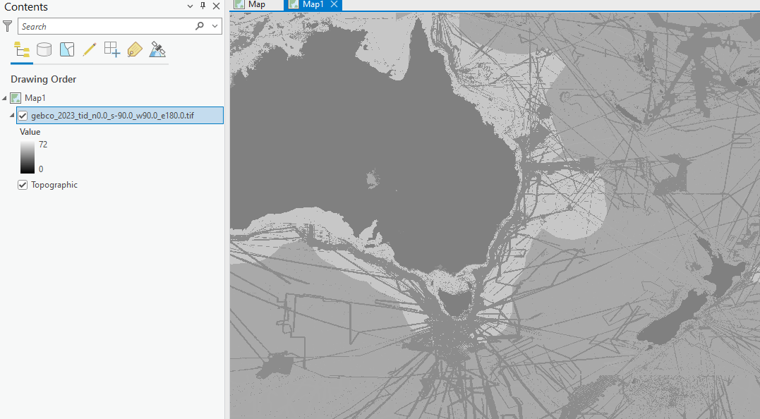
Added the tif to my ArcGIS Pro Map with a view to add to a BIS,
Is there anything I need to do here as the stretched pixel value goes from 0-72. Is there a step missing to show the actual depth of the ocean?
Thanks



