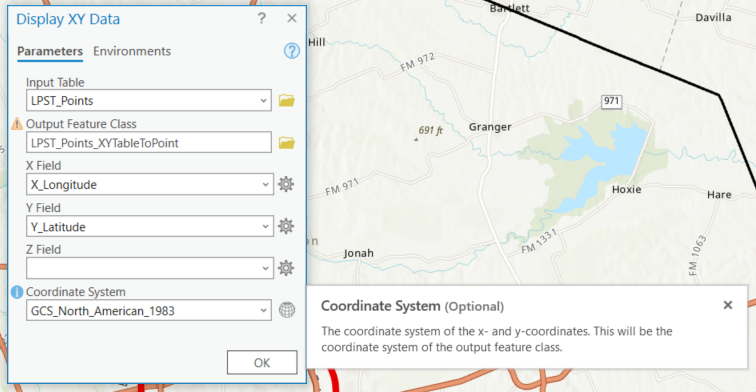
Hello, and please see screenshot below of the Display XY Data tool for reference.
The Coordinate System input for this tool concerns me in several ways:
1. Am I correct that the default is the Map's coordinate system?
2. Regardless, it is suggesting that whatever this is set to will be the Output coordinate system.
But, my understanding has always been that this needs to be "defined" because it is a Standalone table and is "unknown".
With that, it is the Input coordinate system that is defined here; and the Output coordinate system will be that same thing.
With that, how is this "Optional"?
Thanks to anyone who may be able to clarify this


