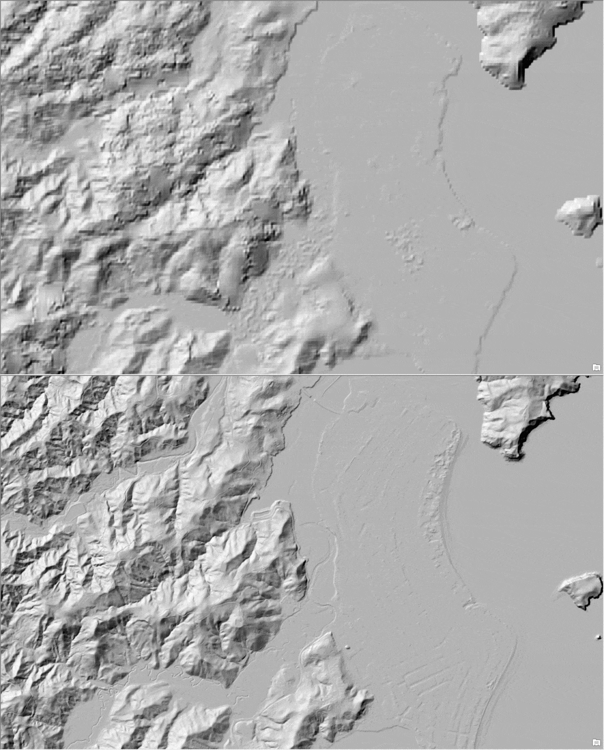
ArcGIS Living Atlas of the World provides foundation elevation layers and tools to support analysis and visualization across the ArcGIS system. These layers get updated quarterly with high resolution elevation data from federal agencies, open sources, and community maps program. World elevation layers have been updated with many high-resolution elevation datasets.
For more information on these updates, see High resolution data updates to Living Atlas World Elevation layers and tools.
Visit the ArcGIS Living Atlas home page to learn about what's new and how to use content. See the ArcGIS Living Atlas blog for more blog articles that help you get the most out of Living Atlas.
Sometime within the last few months these no longer work in analyses. I have a project for a class I teach that uses Extract multi values to points for a small number of points and they have historically used the elevation, slope, and aspect processing templates. Now we all just get error 001268 that the Living Atlas layers are invalid. All signed in, all subscribers with credits.
Hi @mrmark , There have not been any changes to elevation layers since October. The last update was for data and shouldn't affect any functionality. I am wondering if you have updated the ArcGIS Desktop software that might have caused the issue?
Since you are using Extract multi values to points, you can use our ready-to-use Summarize Elevation tool (In ArcGIS Pro, Analysis - Ready To Use Tools - Summarize Elevation). This can provide elevation values along with slope and aspect. https://pro.arcgis.com/en/pro-app/latest/tool-reference/ready-to-use/summarize-elevation.htm
Hope this helps!
Thanks for your response @RajinderNagi
Digging into it a bit it turns out it is exactly what I thought, unfortunately there is no way for an end user to fix it, and until Esri fixes it, the terrain service is mostly useless.
So far it is still much easier to just download the DEM of areas I need and create my own slope and aspect layers than to use the esri services.
@mrmark ,
The limits are there due to licensing restrictions and to enable fair use of the services and make sure someone intentionallyor unintentionally not run something which overwhelm the systems and effect other users hitting the system.
Summarize Elevation has 1000 features limit and it's documented in the tools help page, which is accessible from the "?" symbol within the tool itself. It clearly states.
"The maximum number of input features is 1,000. If more than 1,000 input features are provided, the tool will return an error and will not execute."
https://pro.arcgis.com/en/pro-app/2.9/tool-reference/ready-to-use/summarize-elevation.htm
Note that 5000 rows x 5000 cols limit is for Terrain image service and NOT for Summarize Elevation.
Can you provide reproducible case If your input features are less than 1000 and it's still not working?
On the other hand, Terrain image service is a multi-source, multiresolution service with default pixel size of 0.25m, which is based on finest data within it. For analysis, you would need to use Make Image Server Layer tool where one can define resolution, extents (less than 5000 x 5000) etc. to create a temp layer, which then can be used in other tools.
Here is UC tech workshop covering analysis with Pro at mark 12:30 - 26:00. https://mediaspace.esri.com/media/t/1_ofro14se
Signed in members can post, follow updates, and more. New here? Register a free account.
Find useful guides, FAQs, and documents to help you navigate and make the most of Esri Community.