FYI, 2 great articles that discuss how local government are using GIS technology and Operations Dashboard for ArcGIS in particular, to help with the opioid epidemic.
1. The Herald-News: Will County GIS important for information gathering
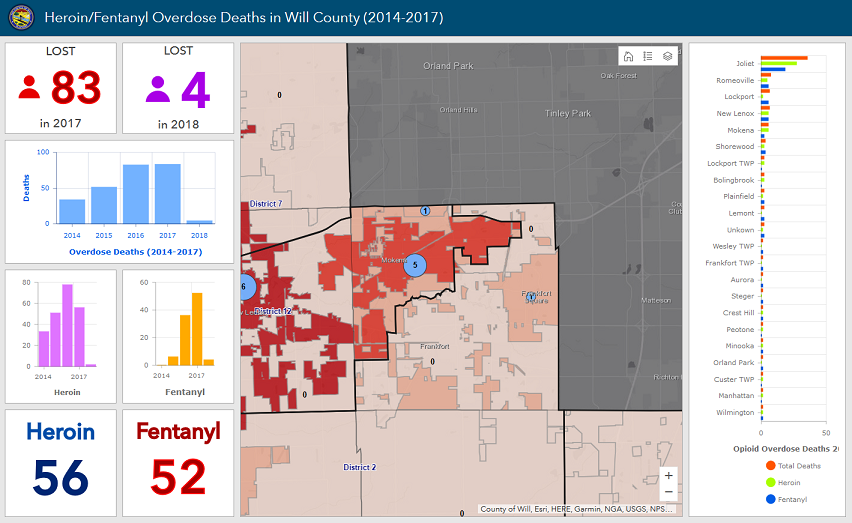
For the opioid crisis, the Will County GIS Division helped identify where heroin overdose incidents occurred, how many people were saved by Narcan, and locations to drop off unused prescription drugs.
Heroin/Fentanyl Overdose Deaths in Will County (2014-2017) Dashboard
2. City of Tempe News: New map will help Tempe combat opioid abuse
Tempe is the first city in Arizona to create a data map showing opioid abuse demographics, locations of probable opioid abuse calls for service and the times they are happening.
------------------------------------------------------------------------------------------------------
-------------------------------------------------------------------------------------------------------
Hope this helps,


