Hi everyone,
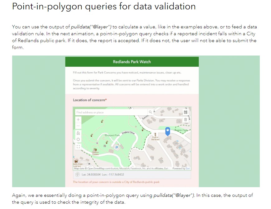
I'm having some trouble in S123 Connect with having submitters place a point on a map - to check if the point falls within a certain polygon. From all the research I have done to try and implement this, I can't find a good example of what I am trying to do. Below is a screenshot from a "Survey123 Tricks of the Trade" post showing what I want to recreate, however, it does not show what I'm actually supposed to do in Connect to make this work.
I know how to use the pull data function to query other question answers, but I'm not sure how to do this for data validation on a geopoint question.
Basically, I have a geopoint question with a buffer on a basemap - any points that are made outside the buffer a note will pop up stating that they are within or outside the buffered zone.
Any help would be greatly appreciated! Thanks!