I'm looking at the attributes table of the web application displayed on our Hub site: https://ak-lsli-adec.hub.arcgis.com/
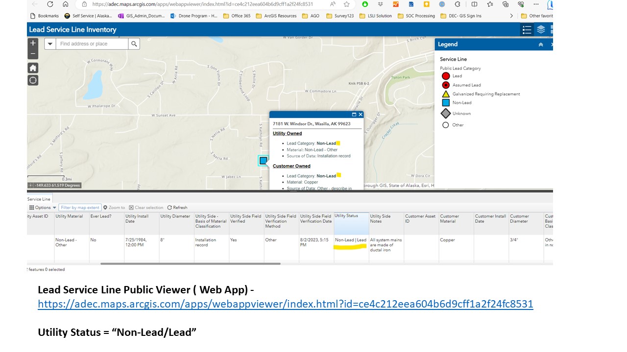
At the bottom of the page is our Lead Service Line Public Viewer - Web Mapping Application. Direct link: https://adec.maps.arcgis.com/apps/webappviewer/index.html?id=ce4c212eea604b6d9cff1a2f24fc8531
In the attribute table in the application, the Utility Status and Customer Status fields have two entries in one cell: Lead I Non-Lead, Lead I Lead, etc... They symbology is correct in the map, but the attribute fields are not.
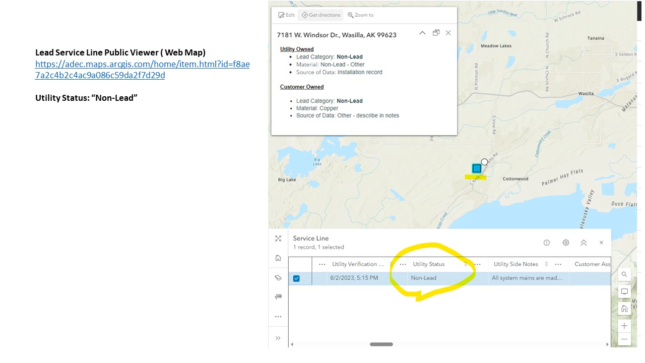
The web map used to create the app: Lead Service Line Public Viewer
https://adec.maps.arcgis.com/home/item.html?id=f8ae7a2c4b2c4ac9a086c59da2f7d29d has the correct information in the attribute (one entry per cell)
I understand there's some sort of expression being used but I'm not sure where this is located. In the screenshots provided, I don't understand why the Utility Status is displaying- Non-Lead I Lead
We've made some modifications to the original solution, so I'm hoping that we didn't mess up and arcade expression behind the scenes. How can I get the Utility Status and Customer Status fields to display what is entered in the Service Line Public Viewer (web map)?