I am trying to download/export a raster based on a query of USGS's 3DEP Image Service. The endpoint (if that's the correct terminology) is here:
https://elevation.nationalmap.gov/arcgis/rest/services/3DEPElevation/ImageServer/exportImage?bbox=-2.00375070672E7,-1689391.823360186,2.0037507532527123E7,1.88090019719E7
Here is what this looks like using the HTML interface. Clicking "Export Image (GET)" initiates a download of the raster as a .tif file, exactly as I need.
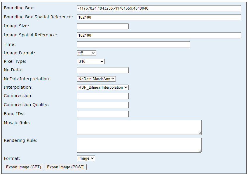
I would like to be able to do this using Python/ArcPy exclusively (updating the parameters as needed), as part of a larger script. I have had a shockingly difficult time Googling this or finding any resources about how to do this, so I'm missing some very basic concepts here.
The code below returns... something, but I don't know how to interact with whatever it is. I just need the actual raster data (a tif? a numpy array? anything?) to do some other geoprocessing with.
import requests

url = \
    r"https://elevation.nationalmap.gov/arcgis/rest/services/3DEPElevation/ImageServer/exportImage?"

params = {"f": "html",
          "bbox": [-2.00375070672E7, -1689391.823360186, 2.0037507532527123E7, 1.88090019719E7],
          "imageSR": 102005,
          "format": "tiff",
          "pixelType": "S16",
          "noDataInterpretation": "esriNoDataMatchAny",
          "interpolation": "RSP_BilinearInterpolation"}

response = requests.get(url=url, params=params, allow_redirects=True)
print(response.text)

# Something like this...
# queried_DigitalElevationModel = response.getData()?
# arcpy.Raster(queried_DigitalElevationModel).save("localfilepath or memory")




