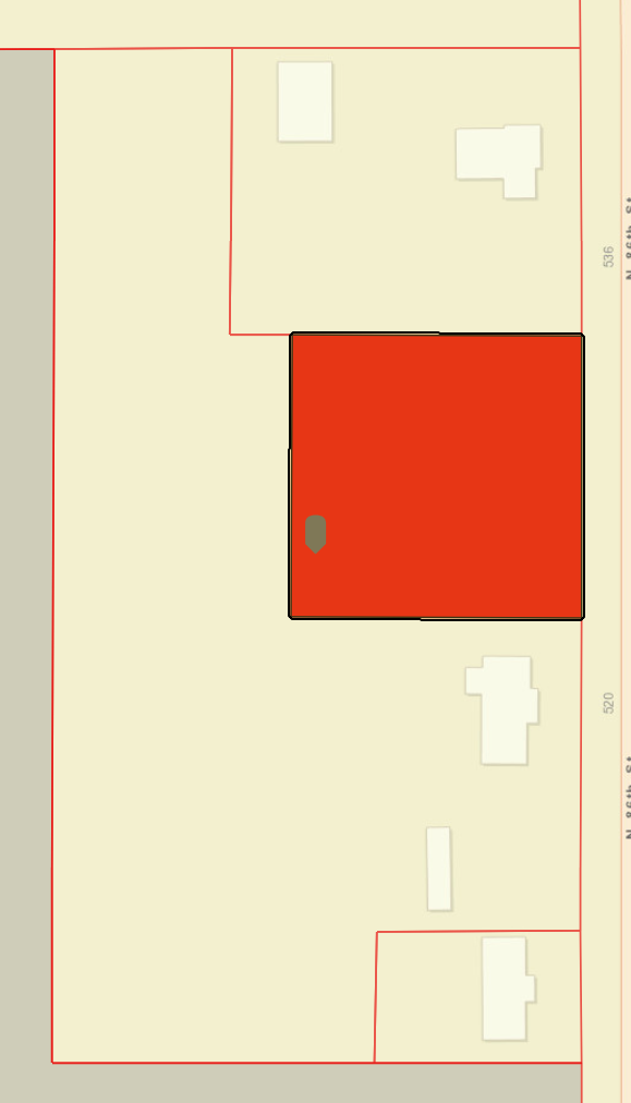
Users are selecting their address based on our parcel (polygon) layer. It seems that when a selection is made, the tool attempts to find a center point thinking the parcel is square or rectangular shaped (I could be totally wrong). If that center point falls inside a different parcel, other than the one selected, those are the results given... not the selection. If you attempt to manually select your desired polygon, it reselects the polygon in which that "center" resides. I tested this on multiple other parcels with similar shapes, and it's a global problem. In the image below, when I search the address for the irregular shaped (transparent) parcel, the gray point is placed inside the incorrect (red) parcel and those results are given. If I manually select the parcel to the north, the results are correct, but if I click back in the desired parcel, it still returns the results of the red parcel.
In the configuration, I thought enabling the 'Show selected result only' option under Style Results would work, but I was wrong.
Any help to fix this would be appreciated!