We have an ArcMap tool helping end-users to georeference pdf/tiff maps. The maps come with drawn and numbered grids on them, and the tool uses grid intersections to georeference the map. Also, end-users can create to aid the visibility of a given cell size, row, and column.
I have two questions:
1. I checked the ArcGIS pro georeferencing tool and it is superior to what ArcMap offers. I find functionalities for the old tool already available in ArcGIS Pro except for creating grids. Do you think it is worth converting this old tool ArcGIS Pro tool? I would like to have your opinion on that if you use/know both georeferencing options.
Picture of the old tool. X: Not needed
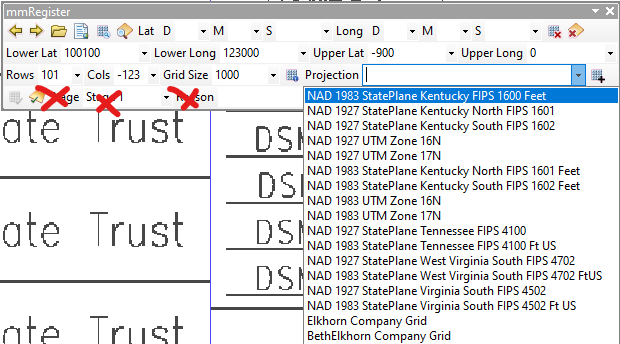
2. Is there a class/method in the SDK I can use for georeferencing. Maybe something like this :
sourcePoint1 = x, y...
targetPoint1 = x, y...
controlPoints = { sourcePoint1, targetPoint1, ....sourcePointN, targetPointN}
Georeference (controlPoints, CurrentMapProjection, TargetMapProjection)
I found some bits and pieces but nothing that I am looking for.
I would appreciate any help. Thanks in advance!

