- Waze Traffic endpoint provides a set of coordinates for constructing a polyline to show the slowdown traffic data. This is shown under the nested JSON under "line":
"jams": [
{
"country": "AS",
"city": "Deception Bay",
"level": 5,
"line": [
{
"x": 153.029946,
"y": -27.193773
},
{
"x": 153.029894,
"y": -27.194082
}
],
"speedKMH": 0,
"length": 35,
"turnType": "NONE",
"type": "NONE",
"uuid": 74115178,
"speed": 0,
"segments": [
{}
],
"blockingAlertUuid": "d390204c-634f-4a2f-832e-54bbb14131e6",
"roadType": 20,
"delay": -1,
"pubMillis": 1667099170082
},
- Using an HTTP Poller, we can derive the schema as shown below:
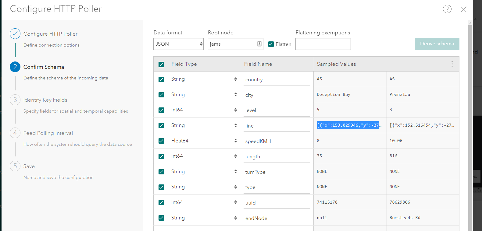
- This gives me a flattened Line field that contains the coordinates in a list like so:
| [{"x":152.516454,"y":-27.51705},{"x":152.50828,"y":-27.515946}] |
- I then specify to this Line field to be the single geometry field, the geom is line, and format is coordinates
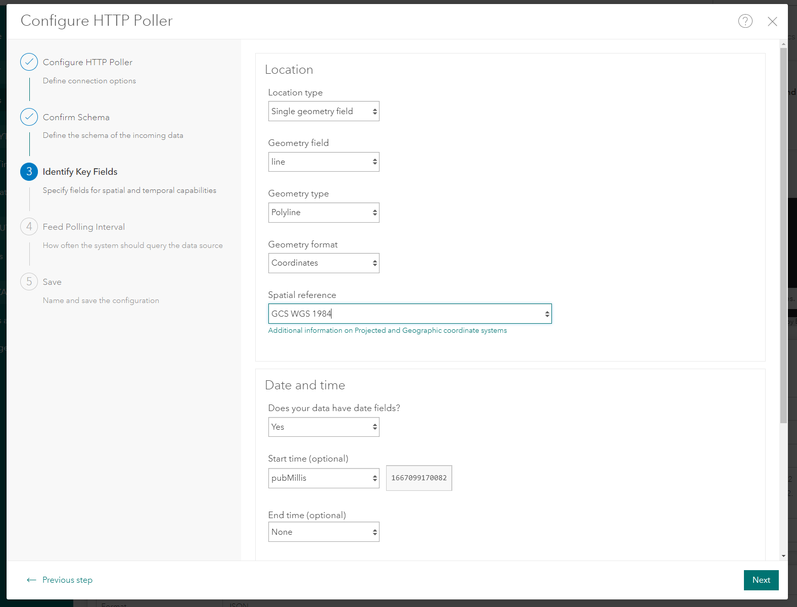
However, due to how the coordinates are currently formatted, I get the following error in the logs:
| WARN: Failed to parse geometry field 'line'. Please make sure your geometry field string is valid. | |
What would the optimal way to parse this JSON feed so that I can ingest it and persist the lines into a spatiotemporal feature layer?





