Hello GIS Community,
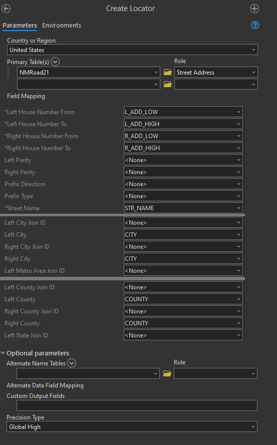
We geocode traffic crash data and have routinely done so using ArcMap Desktop and a composite address locator built off of the State's roadway shapefile. This has worked successfully for more than 10 years by not over-matching incorrect locations. This allows the geocoder to review geocoding options and find or clean street information.
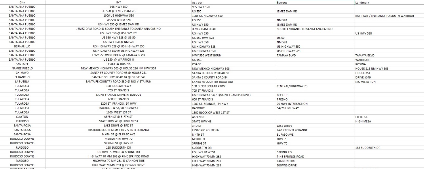
The traffic crash data contains a list of street names or address where crashes took place. We create a single intersection field containing either the address or intersection information for the crash. Along with the City that crash occurred in, we input those two fields into our address locators (sample data below):
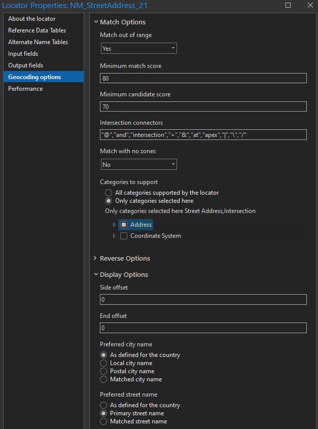
However, as we are attempting to transition this progress to ArcPro we’ve encountered problems with our over-matching of bad addresses or intersections. Below are our ArcPro Address Locator properties:
We have pulled out some results that are particularly wrong, many of which we could not realistically use match score to filter out. Most of them have matches that include a single piece from directly next to the intersection connector but ignore most of the rest of the input. For example, an input address of an intersection “I 40 @ Carlisle Blvd NE” yields a street address of “40 Carlisle.”
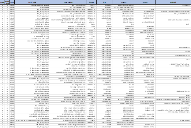
Typically, we would expect this to have a low match score and to be able to filter results like this out, but some of these results have a match score of more than 95. Many of the poor results follow the above pattern, but not all of them. An input address of “Tramway Blvd NE @ E/B Interstate 40 off ramp” gives a match of “E & I, Albuquerque.”
The locator only includes streets so we would expect this to not match. Up to this point we have been using locators that were originally created in ArcCatalog but the transition to ArcPro 3.0 has made these unavailable for use.
My question is, what is causing these poor matches and is there anything I can change to prevent them from matching?

