Hi there. I've been constructing a new python tool in ArcGIS Pro which generates a point file around an existing shapefile of polygons:
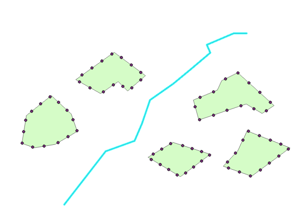
I now want to calculate which one of these points for each polygon is closest to the road (the polyline that runs down the centre). However, although I can calculate this value in my script, I am having difficulties selecting the closest point and writing it as a new shapefile.
I initially used Arcpy Near (Analysis) to return the distance of every single point to the road (please refer to my code at the bottom of the post).
I then tried an arcpy Select By Attribute command to select the point with the lowest distance for every group of points (points that sit on the edge of the same shape share a common original FID, field as seen in the attribute table):
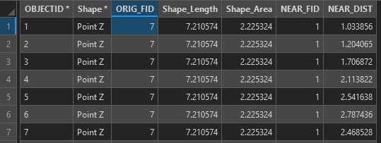
The SQL expression looked like this, using the select by attribute tool.
NEAR_DIST = (SELECT MIN(NEAR_DIST) FROM asset_points GROUP BY ORIG_FID)
However, that didn't return the minimum value for each of the groups; only the first group in the point file attribute table.
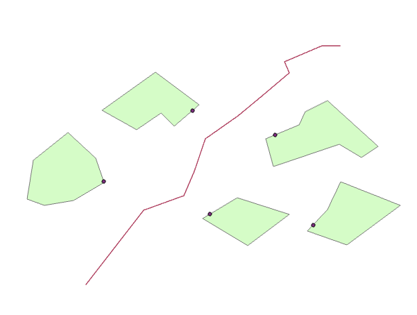
Does anybody have any ideas about how I can achieve this, and then slot it into my python script? Here is what my desired output might look like:
Any help would be much appreciated. For reference, here is my current script:
# -*- coding: utf-8 -*-

import arcpy
import numpy

class Toolbox(object):
    def __init__(self):

        self.label = "FindMinimumPoint"
        self.alias = "toolbox"


        self.tools = [Tool]


class Tool(object):
    def __init__(self):

        self.label = "FindMinimumPoint"
        self.description = "FindMinimumPoint"
        self.canRunInBackground = False

    def getParameterInfo(self):

        # Param 0 = Road
        param0 = arcpy.Parameter(
        displayName="Road",
        name="Parameter0",
        datatype="GPFeatureLayer",
        parameterType="Required",
        direction="Input")

        # Param 1 = Shapes
        param1 = arcpy.Parameter(
        displayName="Shapes",
        name="Parameter1",
        datatype="GPFeatureLayer",
        parameterType="Required",
        direction="Input")

        params = [param0,param1]

        return params

    def isLicensed(self):

        return True

    def updateParameters(self, parameters):

        return

    def updateMessages(self, parameters):

        return

    def execute(self, parameters, messages):

        # Overwrite existing file of the same name

        arcpy.env.overwriteOutput = True

        # Reference Parameters

        road = parameters[0].valueAsText
        shapes = parameters[1].valueAsText

        # make feature layer

        arcpy.management.MakeFeatureLayer(shapes, "shapes_lyr")

        # Generate points along shape edges

        arcpy.management.GeneratePointsAlongLines("shapes_lyr", "shapes_points", 'PERCENTAGE', Percentage=7)

        # Find distance of each vertex to road

        arcpy.analysis.Near("shapes_points", road)


        return





