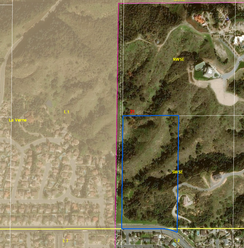
I have PLSS data that is supposed to line up with a city's easterly boundary line yet it does not.
There is about a 70 foot gap between the SWSE western quarter section line of the SE quarter of section 31 and the City of La Verne's eastern boundary section line.
My POB is the south quarter corner of section 31 of T1N R8W.
My data frame properties and projected coordinate system for all data is in NAD 83 California V FIPS (V for LA County).
The polygon's western border line was drawn up from where the south quarter corner of section 31 lies.
This northerly running line that transects section 31 is also the SWSE's western line of the SE quarter of section 31 yet they do not align with the city boundary which according to the tract map is all supposed to align together.
I have contacted the engineer working on this parcel and he instructed that he is going off the tract map and that the GIS data is wrong. It is wrong but I'm not sure if that is my doing or the data itself.
Attached is a photo.
After drawing up this polygon I am supposed to combine it with the city boundary and detach from a polygon not shown. I am going to simply align the polygon up with the eastern boundary line of the City of La Verne and merge them together.
I would like to avoid moving the polygon and have the parcel draw up and the lines aligned properly otherwise I will have to use the workaround of moving the polygon west and merging.