Hello, first time positing so I hope this is the correct place.
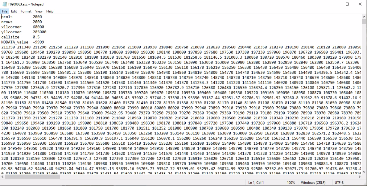
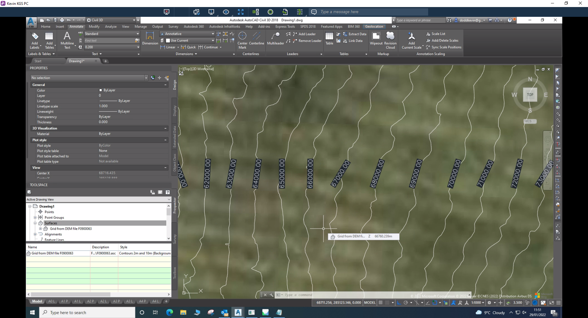
I have received multiple .asc files (Lidar Data) that I would like to create a surface from in Civil3D Autocad. However, when I load in the file it looks like the height values are in millimetres. Do .asc files from ArcGIS always have heights in millimetres or can they be exported with heights in metres?
Thanks in advance.