Hello,
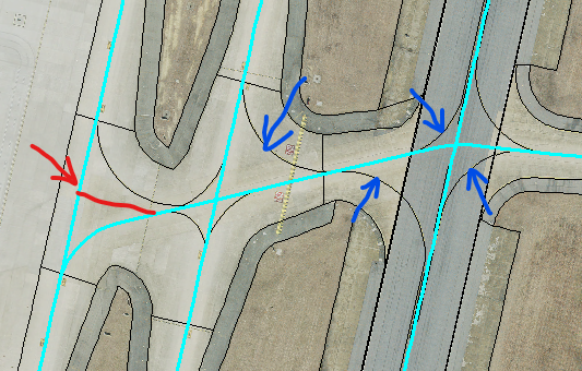
I am new to Network Analyst. I need to analyze response times from 4 locations on an airport to see which one is the best location. I have no road network so I need to build one. I was going to use data obtained from a training tutorial as the template for the road network. I am going to create the centerlines from airport runway lines. My question is this. The airport runway lines have all of the curves (turns) already mapped out (blue arrows). Should I include these in my centerline file? OR should I leave them out and create straight intersection so that when I build the network it resembles a traditional roadway intersection (red arrow)?
If it matters I am using network analyst extension inside ArcGIS Desktop