ArcGIS Pro 2.8
Hello everyone, I have been working at learning 3D for almost a week straight trying to figure out how to properly map subsurface features like the following links:
https://www.arcgis.com/home/item.html?id=1e63a7a244b04f90993ab2474059f745
https://www.esri.com/about/newsroom/arcnews/subsurface-utility-data-modeled-in-3d/
Some of the issues I'm running into: (Preface: I'm using esri 3D testing data so Proj is NAD 1927 UTM Zone 10N and Vertical is NGVD 1929)
- Created a z-aware feature class but it doesn't reflect accurate height values when given a height/depth field with a range of whole numbers. Making those numbers negative doesn't set the features below the surface.
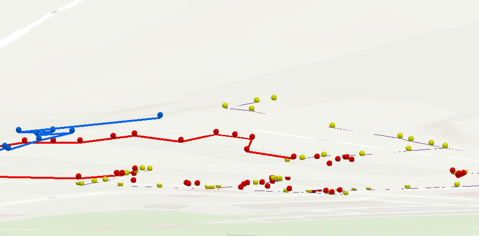
- The points and lines features move around when panning around or above/below ground. In those links above, the features are static. What setting do I need to change?
- Points can have values in the attribute table to represent the z value, but lines cannot, otherwise they would be flat, no? So, how does one share z aware lines to others without losing that z value? Should the geometry be saved? It hasn't in my experience.
- Is there a better way to bring in lines with z awareness? At the moment, it seems I can only attempt to set my points on the ground, force them underground, then slowly draw lines from point to point.
Here is my very sad attempt with a small collection of utility lines:
Please help my poor self. Thank you.


