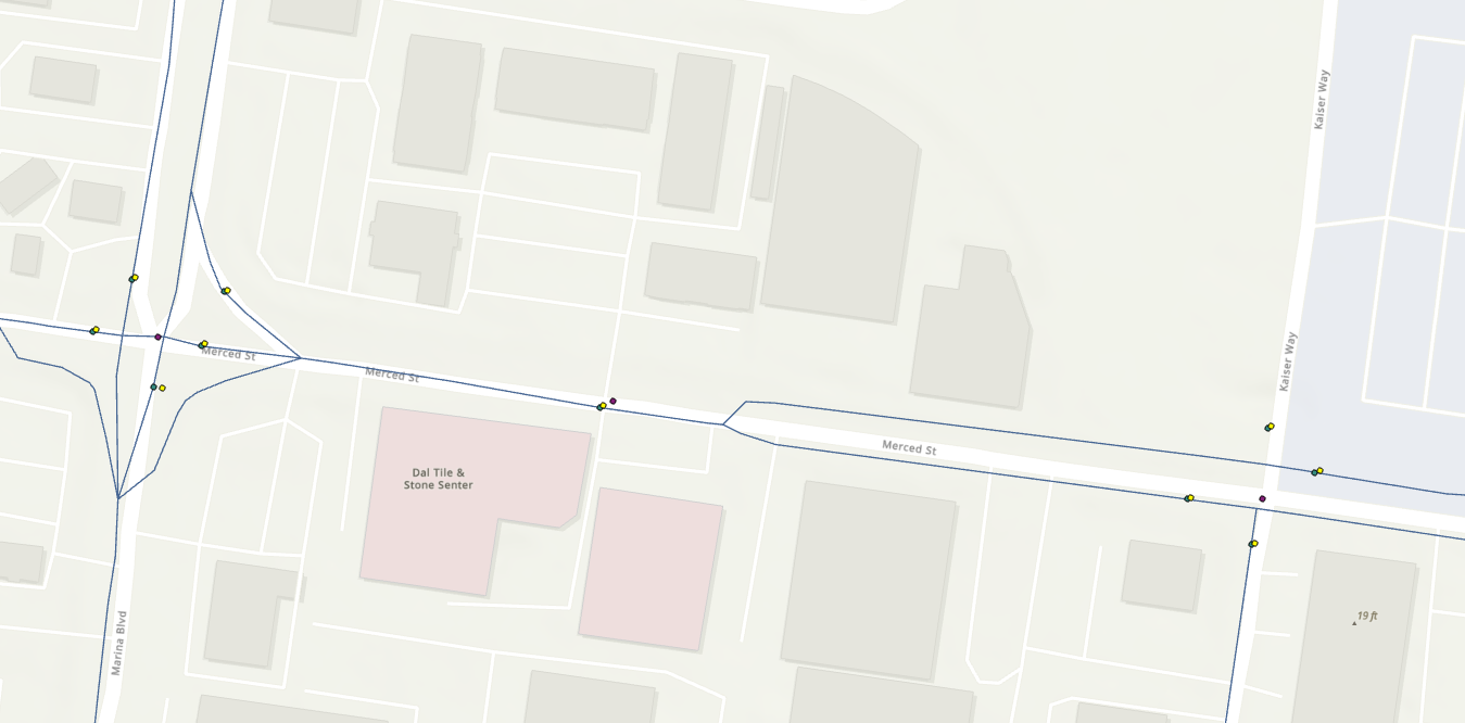
Hello. I am working with various gdb line and point feature classes but struggling with the projection and having these layers align with one another on the map.I was wondering if anyone could assist me with this issue.
OpenStreetMap data (blue line) was previously extracted a few years ago and are aligned with the road intersections shown in green. These are in the NAD 1983 (2011) San Francisco CS13 projection. However, I have a recently extracted OSM intersections layer (in yellow) that do not align with the lines or the existing points. I also have a local city layer (purple) that also do not align. All of these layers are projected with the same San Francisco projection.
Is there something I'm doing wrong? I'm using the "Project" tool as well as setting the coordinate system for the dataframe. I also created a new geodatabase to house the two unaligned point feature classes in case the issue was with the gdb coordinate system. I am totally confused! Any thoughts are appreciated, thank you.
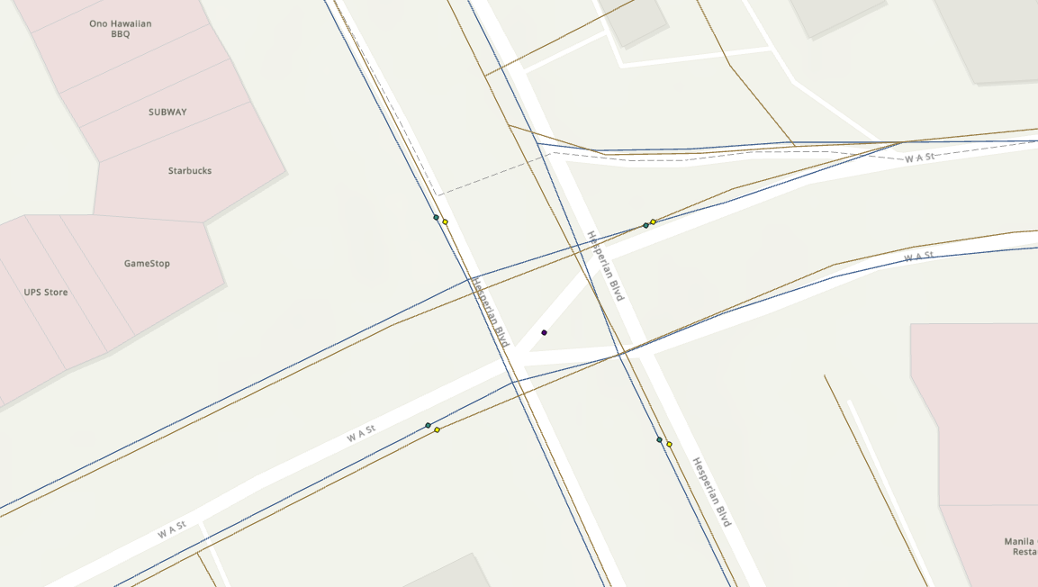
Edit: I should note that the OSM data I extracted with the intersections (in yellow) align with one another, with the same SF projection. But I can't seem to understand why the two pairs are not aligned. The city points (purple) is not aligned with either. (See second photo below).